USSR Ministry of Defense
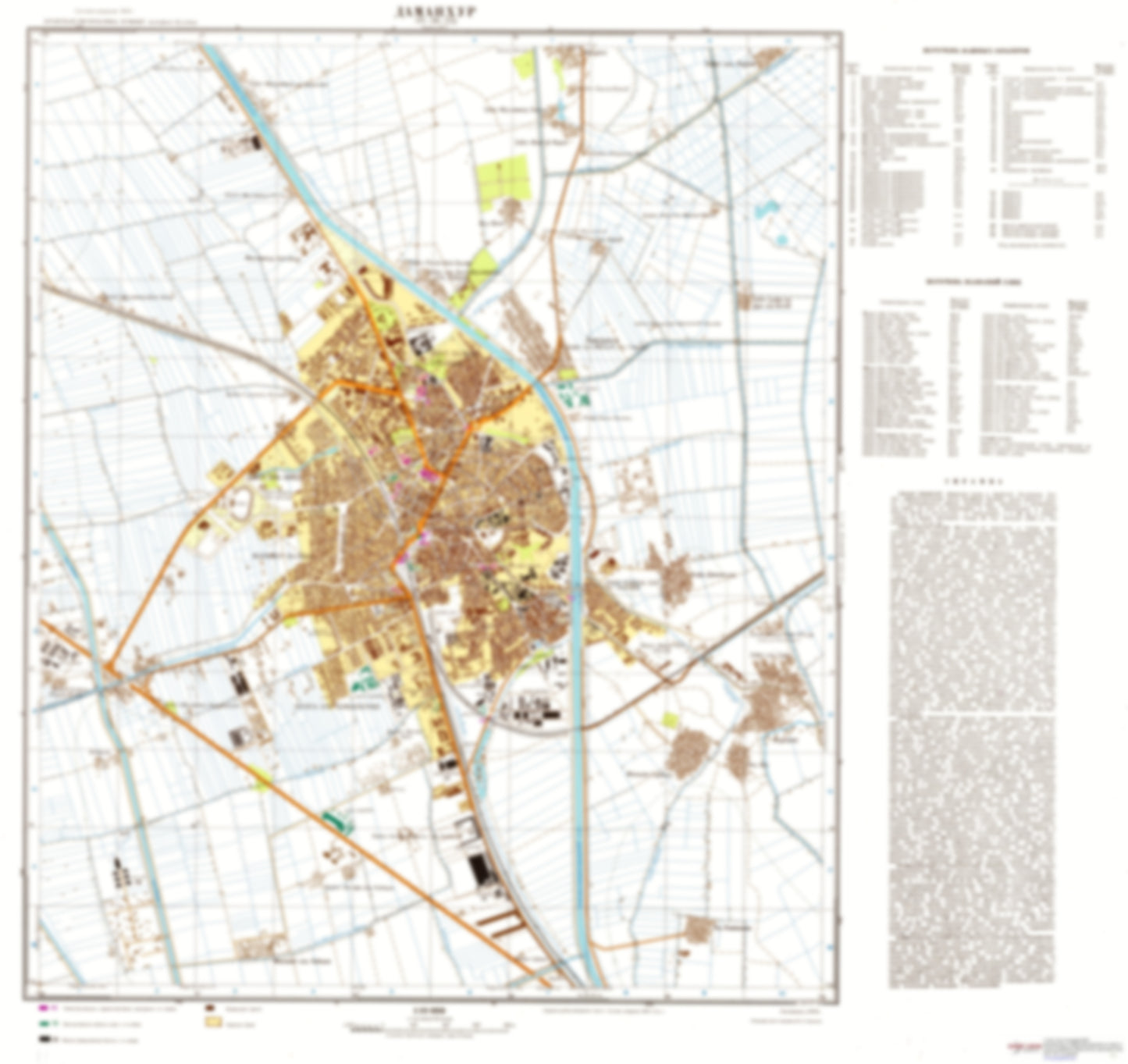
Damanhur (Egypt) - Soviet Military City Plans
Damanhur (Egypt) - Soviet Military City Plans
Regular price
$49.95 USD
Regular price
Sale price
$49.95 USD
Unit price
per
Shipping calculated at checkout.
Couldn't load pickup availability
- SKU: SUAA-DAMANHUR-P
- During the Cold War and before easy access to high-resolution satellite imagery, The Soviet Military was secretly mapping the entire world. These aesthetically striking maps are beautiful down to the last detail and fantastic wall art and until now, have rarely been viewed or available to outsiders. This series has been covered by Wired Magazine and Greg Miller in his book, "All Over the Map: A Cartographic Odyssey". This map is part of the Soviet City Plans Series presented by East View, which has the largest collection of Soviet Military City Plans in the world. The Soviet Military City Plan(s) of Damanhur (Egypt) is one in a series of highly detailed topographic city maps developed by the USSR Ministry of Defense during the Cold War era. These collectable, high resolution print-on-demand editions are delivered on premium, acid-free, matte paper. This item is sheet number 1 in a set of 1 sheet(s) for Damanhur Populated Places: 'Izbat 'isa Bulus, 'Izbat AHmad al Mabruk, 'Izbat al Hamamiyah, 'Izbat al Hawsh, 'Izbat al Hawsh, 'Izbat al Hawsh al Bahriyah, 'Izbat al Hissah, 'Izbat al Katib, 'Izbat al Kawm, 'Izbat al Khamari, 'Izbat Balba', 'Izbat Israf, 'Izbat Kitat, 'Izbat Raghib, 'Izbat Sa'id al Habashi, 'Izbat Sayf ad Din, 'Izbat Shubra, Dahshur, Iflaqah, Manshiyat al Habashi, Manshiyat Ghurbal, Qaraqis Landmarks and Natural Features: Jami'At al Azhar
- Subtype: City Plan
- Language: Russian
- Publication Date: 1977-06-01
- Scale: 1:10,000
- Countries Covered: Egypt
- MPN: DAMANHUR
- Folded Size: N/A
- Unfolded Size: 28.4" (W) x 26.8" (H)
- Weight: 4.8 oz