Raven Maps
Countries of the World Elevation Tints Fine Art Print Map
Countries of the World Elevation Tints Fine Art Print Map
Couldn't load pickup availability
- SKU: PODRP_WOR_POL_ELEV_44X25_WA
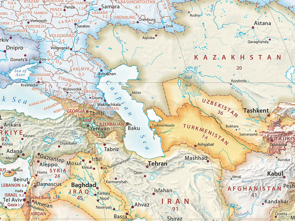
Our Countries of the World map is just what it claims to be, offering a clean yet detailed view of the planet's political divisions with hand-picked hues highlighting country boundaries and color palettes that tie continents and regions together. Transportation networks are omitted in favor of country populations, major cities, and notable geographic features (rivers, islands, and island groups), all laid over simple, evocative shaded relief. The four corners of the print host a complete listing of countries, sorted by continent and listed by population from largest to smallest.
The 2025 edition features extensive updates, including revised city data for rapidly growing regions, refreshed state, province, and country populations, and new shaded relief with bathymetric detail. These updates make this handsome and legible map even more visually engaging while enhancing its utility as both a quick reference and a gorgeous view of the world's countries.
Dimensions: All map dimensions are approximate.
- Type: Flat Map
- Subtype: Wall Art
- Language: English
- Regions Covered: World
- UPC: 767020016243
- MPN: countries-world-elevation-tints-map
- Folded Size: N/A
- Unfolded Size: 44" (W) x 25" (H)
- Weight: 16 OUNCES
- Finish: Regular Paper