Raven Maps
Connecticut Archival Print Map
Connecticut Archival Print Map
Couldn't load pickup availability
- SKU: PODRP_CT_ARCHVL_14X11
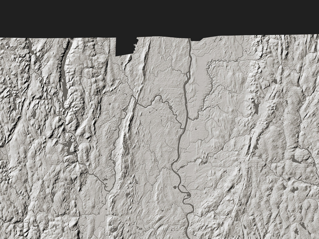
Connecticut is the relatively low-elevation southern end of New England’s Appalachians. Erosion and glaciation have subdued the topography and left glacial deposits on the underlying bedrock, but the Appalachian grain remains evident. The Connecticut River Valley is a surviving 200-million year old tectonic rift.
About Archival Prints
For the lover of landforms, the delicacy and precision of the imagery is what matters. These maps are pure monochrome landform: without the names and built-up areas that appear on our Fine Art Print Landforms and Rivers maps (rivers and streams are shown, but not named). These prints are a revelation, inviting endless contemplation, without distraction.
For a print-lover, the unsurpassed quality and permanence of both paper and inks may be their most important qualities. These special edition archival prints offer unequaled definition and subtlety of tone. Printed in 8 inks on 350g Hahnemühle 100% cotton Museum Etching paper, these are the gold standard.
All map dimensions are approximate. Archival prints are printed at Jeff Gaydash Studios. Please allow three weeks for delivery. Archival prints are non-returnable. Please contact us (info@ravenmaps.com) for samples of archival print paper.
- Type: Flat Map
- Subtype: Wall Art
- Language: English
- Regions Covered: Mid-Atlantic/Northeastern U.S., North America
- Countries Covered: United States
- States Covered: Connecticut
- UPC: 767020011620
- MPN: connecticut-archival-print-map
- Folded Size: N/A
- Unfolded Size: 14" (W) x 11" (H)