Longitude Maps
Colorado Archival Print
Colorado Archival Print
Couldn't load pickup availability
- SKU: PODRP_CO_ARCHVL_14X11
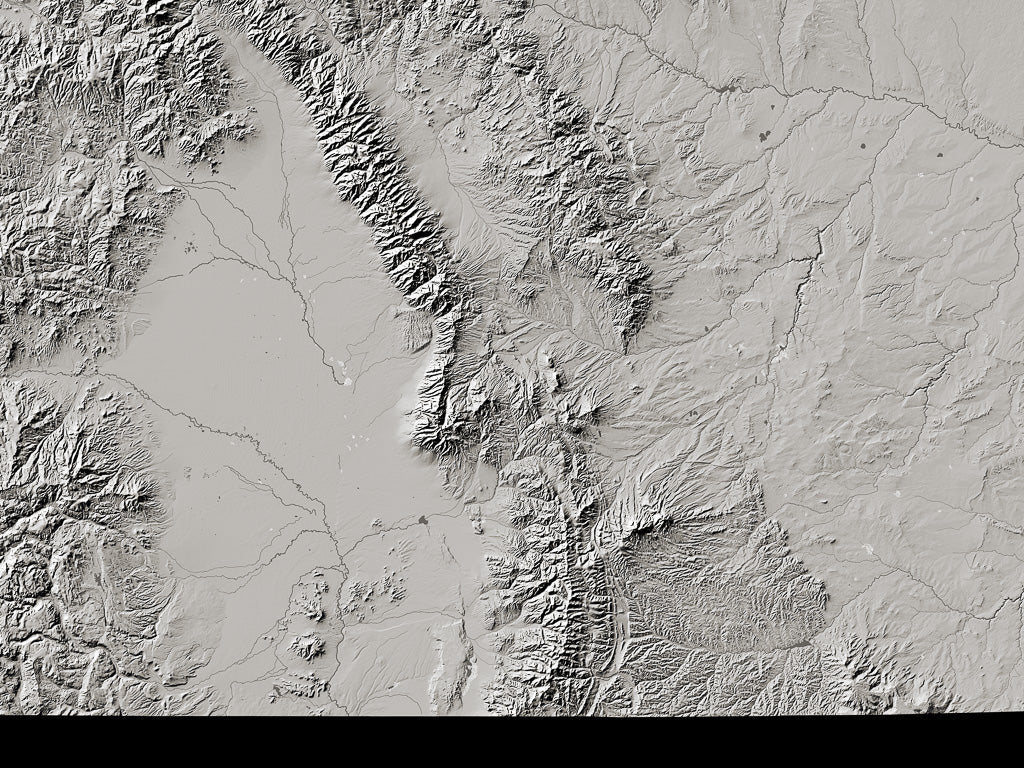
The Platte River portion of the Great Plains Front Range ends abruptly at the unbroken wall of the Rocky Mountain Front Range. The Sangre de Cristo Mountains mark the end of the Southern Plains only slightly less decisively. All of Colorado's "Western Slope" feeds the Colorado-Green system. The central ranges are the source of the Arkansas , and the San Juans feed the Rio Grande, which swings from east to south through the San Luis Valley.
About Archival PrintsFor the lover of landforms, the delicacy and precision of the imagery is what matters. These maps are pure monochrome landform: without the names and built-up areas that appear on our Fine Art Print Landforms and Rivers maps (rivers and streams are shown, but not named). These prints are a revelation, inviting endless contemplation, without distraction.
For a print-lover, the unsurpassed quality and permanence of both paper and inks may be their most important qualities. These special edition archival prints offer unequaled definition and subtlety of tone. Printed in 8 inks on 350g Hahnemühle 100% cotton Museum Etching paper, these are the gold standard.
All map dimensions are approximate. Archival prints are printed at Jeff Gaydash Studios. Please allow three weeks for delivery. Archival prints are non-returnable. Please contact us (info@ravenmaps.com) for samples of archival print paper.
- Type: Flat Map
- Subtype: Wall Art
- Language: English
- Regions Covered: Central U.S., North America
- Countries Covered: United States
- States Covered: Colorado
- UPC: 767020011330
- MPN: colorado-archival-print-map
- Folded Size: N/A
- Unfolded Size: 14" (W) x 11" (H)