Fish-n-Map Company
Coeur d'Alene Lake, Priest Lake Fishing Map
Coeur d'Alene Lake, Priest Lake Fishing Map
Couldn't load pickup availability
- SKU: FNM_CO_PL_22
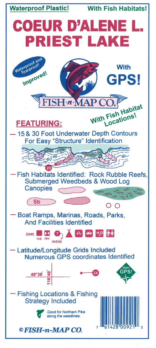
Fish-N-Map Company underwater topography maps are printed on a waterproof, tear-resistant material and are folded to 9" x 4". When opened, each map is approximately 3' x 2' in size and is printed on both sides. These maps feature waterproof plastic "paper"; underwater depth contours; fish locations; latitude and longitude for GPS; often multiple lakes on one map; boat ramps; recreational facilities; and much more.
2022 UPDATES:
Added onshore trees and brush
Updated Facility List and Telephone Numbers
2020 UPDATES:
• Improved longitude and latitude grids using NAD 83 for datum using 2' grids
• Added new Quick Look Scalers
• Updated GPS Locations
• Improved outline of lakes
• Added fish habitat including:
o Rock Rubble Reefs
o Slab Rock Formations
o Weedbeds
o Wood Log Canopies
• All new Fishing Strategy and Fishing Suggestions
• Updated fish species found in the lakes
• Made Coeur d’Alene bigger – 109% of original
• Updated facilities and roads
• Added an additional color to the map – green
FEATURES:
2 LAKES ON ONE MAP
Printed onto a waterproof, tear-resistant material
Folds to 9" x 4", unfolds to 3' x 2'
15 and 30 foot underwater depth contours
Fish Habitats Identified including rock rubble reefs, submerged weedbeds and wood log canopies
Suggested fishing locations and a fishing strategy provided
Latitude and Longitude Grids shown
Numerous GPS coordinates identified
Boat ramps, marinas, roads, parks and facilities identified
MADE IN THE U.S.A.- Type: Folded Map
- Subtype: Fishing
- Language: English
- Publication Date: 2022-06-01
- Scale: Scale not provided
- Regions Covered: North America, North-central U.S./Great Plains
- Countries Covered: United States
- States Covered: Idaho
- UPC: 761428009210
- Folded Size: 3.94" (W) x 9.06" (H)
- Unfolded Size: 35.83" (W) x 24.02" (H)
- Weight: 1.8 oz