USSR Ministry of Defense
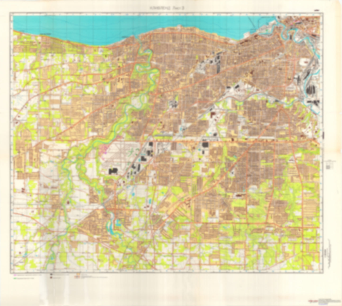
Cleveland, OH 3 (USA) - Soviet Military City Plans
Cleveland, OH 3 (USA) - Soviet Military City Plans
Regular price
$49.95 USD
Regular price
Sale price
$49.95 USD
Unit price
per
Shipping calculated at checkout.
Couldn't load pickup availability
- SKU: SUAA-CLEVELAND3-P
- During the Cold War and before easy access to high-resolution satellite imagery, The Soviet Military was secretly mapping the entire world. These aesthetically striking maps are beautiful down to the last detail and fantastic wall art and until now, have rarely been viewed or available to outsiders. This series has been covered by Wired Magazine and Greg Miller in his book, "All Over the Map: A Cartographic Odyssey". This map is part of the Soviet City Plans Series presented by East View, which has the largest collection of Soviet Military City Plans in the world. The Soviet Military City Plan(s) of Cleveland, OH 3 (USA) is one in a series of highly detailed topographic city maps developed by the USSR Ministry of Defense during the Cold War era. These collectable, high resolution print-on-demand editions are delivered on premium, acid-free, matte paper. This item is sheet number 3 in a set of 4 sheet(s) for Cleveland, OH Populated Places: City of Bay Village, City of Berea, City of Broadview Heights, City of Brook Park, City of Brooklyn, City of Cleveland, City of Fairview Park, City of Lakewood, City of Middleburg Heights, City of North Olmsted, City of Olmsted Falls, City of Parma, City of Parma Heights, City of Rocky River, City of Seven Hills, City of Westlake, Township of Olmsted, Township of Riveredge (historical) Parks and Reservations: Gardner Flats, The Flats Landmarks and Natural Features: Cedar Point, Clifton Beach, Huntington Beach, Perkins Beach, Whiskey Island Water Bodies: Baldwin Lake, Clifton Lagoon, Coe Lake, Eureka Lake, Jaquay Lake, Lake Abram, Lake Isaac, Old River, Smith Road Lakes, Wallace Lake, Wyleswood Lake
- Type: Map
- Subtype: City Plan
- Language: Russian
- Publication Date: 1976-06-01
- Scale: 1:25,000
- Regions Covered: Midwest, North America
- Countries Covered: United States
- States Covered: Ohio
- MPN: CLEVELAND 3
- Folded Size: N/A
- Unfolded Size: 40.5" (W) x 36" (H)
- Weight: 4.8 oz