Fish-n-Map Company
Clear Lake & Lake Berryessa Fishing Map
Clear Lake & Lake Berryessa Fishing Map
Couldn't load pickup availability
- SKU: FNM_CL_LB_24
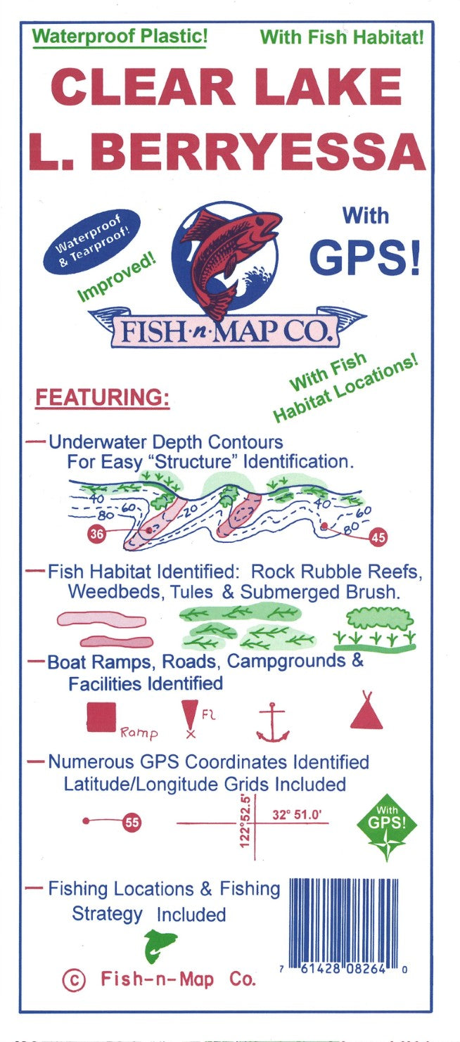
Fish-N-Map Company underwater topography maps are printed on a waterproof, tear-resistant material and are folded to 9" x 4". When opened, each map is approximately 3' x 2' in size and is printed on both sides. These maps feature waterproof plastic "paper"; underwater depth contours; fish locations; latitude and longitude for GPS; often multiple lakes on one map; boat ramps; recreational facilities; and much more.
Updated November 2024
• Added fish habitat for both lakes: Weedbeds, rock rubble reefs, tules (Clear Lake) and submerged brush (Lake Berryessa)
• All new fishing strategies and fishing suggestions for both lakes
• Updated the outlines of both lakes and contours
• Added onshore trees to both lakes
• Changed the latitude and longitude grids from 2 ½-minute grids to 2-minute grids
• Updated facilities
• Now a 3-color map
Features:This 2-sided map is printed onto a Waterproof, Tear-Resistant Plastic which folds to 9" x 4" and unfolds to 3' x 2'.
Underwater Depth Contours for Easy "Structure" Identification
Fish Habitat areas shown including weedbeds and rock rubble reefs
Multiple Fishing Locations with GPS Coordinates Provided
Fishing Strategies Included
2' Latitude and Longitude Grids
Boat Ramps, Campgrounds & Facilities Identified
MADE IN THE U.S.A.- Type: Folded Map
- Subtype: Fishing
- Language: English
- Publication Date: 2024-06-01
- Scale: Scale not provided
- Regions Covered: North America, Western U.S.
- Countries Covered: United States
- States Covered: California
- UPC: 761428082640
- Folded Size: 4" (W) x 9" (H)
- Unfolded Size: 36" (W) x 24" (H)
- Weight: 2.9 oz