USSR Ministry of Defense
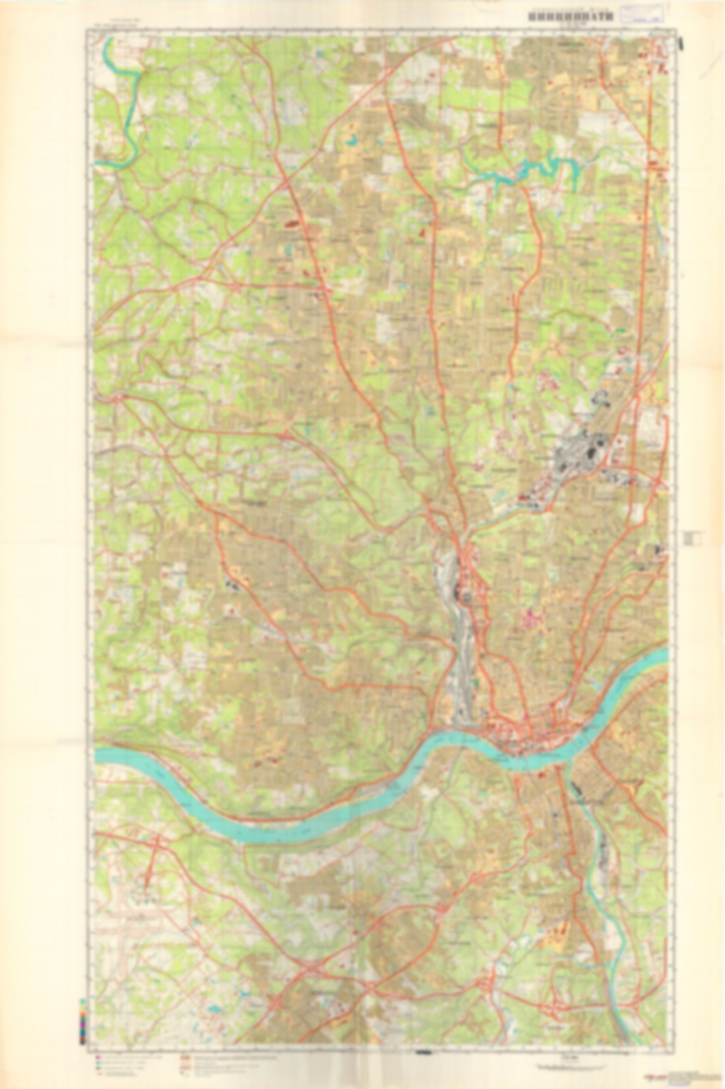
Cincinnati, OH 1 (USA) - Soviet Military City Plans
Cincinnati, OH 1 (USA) - Soviet Military City Plans
Regular price
$49.95 USD
Regular price
Sale price
$49.95 USD
Unit price
per
Shipping calculated at checkout.
Couldn't load pickup availability
- SKU: SUAA-CINCINNATI1-P
- During the Cold War and before easy access to high-resolution satellite imagery, The Soviet Military was secretly mapping the entire world. These aesthetically striking maps are beautiful down to the last detail and fantastic wall art and until now, have rarely been viewed or available to outsiders. This series has been covered by Wired Magazine and Greg Miller in his book, "All Over the Map: A Cartographic Odyssey". This map is part of the Soviet City Plans Series presented by East View, which has the largest collection of Soviet Military City Plans in the world. The Soviet Military City Plan(s) of Cincinnati, OH 1 (USA) is one in a series of highly detailed topographic city maps developed by the USSR Ministry of Defense during the Cold War era. These collectable, high resolution print-on-demand editions are delivered on premium, acid-free, matte paper. This item is sheet number 1 in a set of 2 sheet(s) for Cincinnati, OH Populated Places: City of Bellevue, City of Cheviot, City of Cincinnati, City of Covington, City of Crescent Springs, City of Erlanger, City of Forest Park, City of Fort Mitchell, City of Fort Wright, City of Kenton Vale, City of Ludlow, City of Mount Healthy, City of Newport, City of North College Hill, City of Park Hills, City of Southgate, City of Springdale, City of Villa Hills, City of Wilder, City of Woodlawn, City of Wyoming, Hamilton County, Township of Colerain, Township of Green, Township of Springfield Parks and Reservations: Harper Meadows Landmarks and Natural Features: Bald Knob, Brighton Hill, Clifton Hills, Goat Hill, Johns Hill, Mount Adams, Orchard Hill, Parker Woods, Strauch Island, Walnut Hills Water Bodies: Chateau Lakes Number One, Chateau Lakes Number Two, Delhurst Lake, Dream Valley Lake, Haskin Lake, Lake Gloria, Mirror Lake, Nina Lake, Prisoners Lake, Winton Lake
- Type: Map
- Subtype: City Plan
- Language: Russian
- Publication Date: 1980-06-01
- Scale: 1:25,000
- Regions Covered: Midwest, North America
- Countries Covered: United States
- States Covered: Ohio
- MPN: CINCINNATI 1
- Folded Size: N/A
- Unfolded Size: 35.9" (W) x 53.9" (H)
- Weight: 4.8 oz