USSR Ministry of Defense
Christchurch 2 (New Zealand) - Soviet Military City Plans
Christchurch 2 (New Zealand) - Soviet Military City Plans
Regular price
$49.95 USD
Regular price
Sale price
$49.95 USD
Unit price
per
Shipping calculated at checkout.
Couldn't load pickup availability
- SKU: SUAA-CHRISTCHURCH-2-P
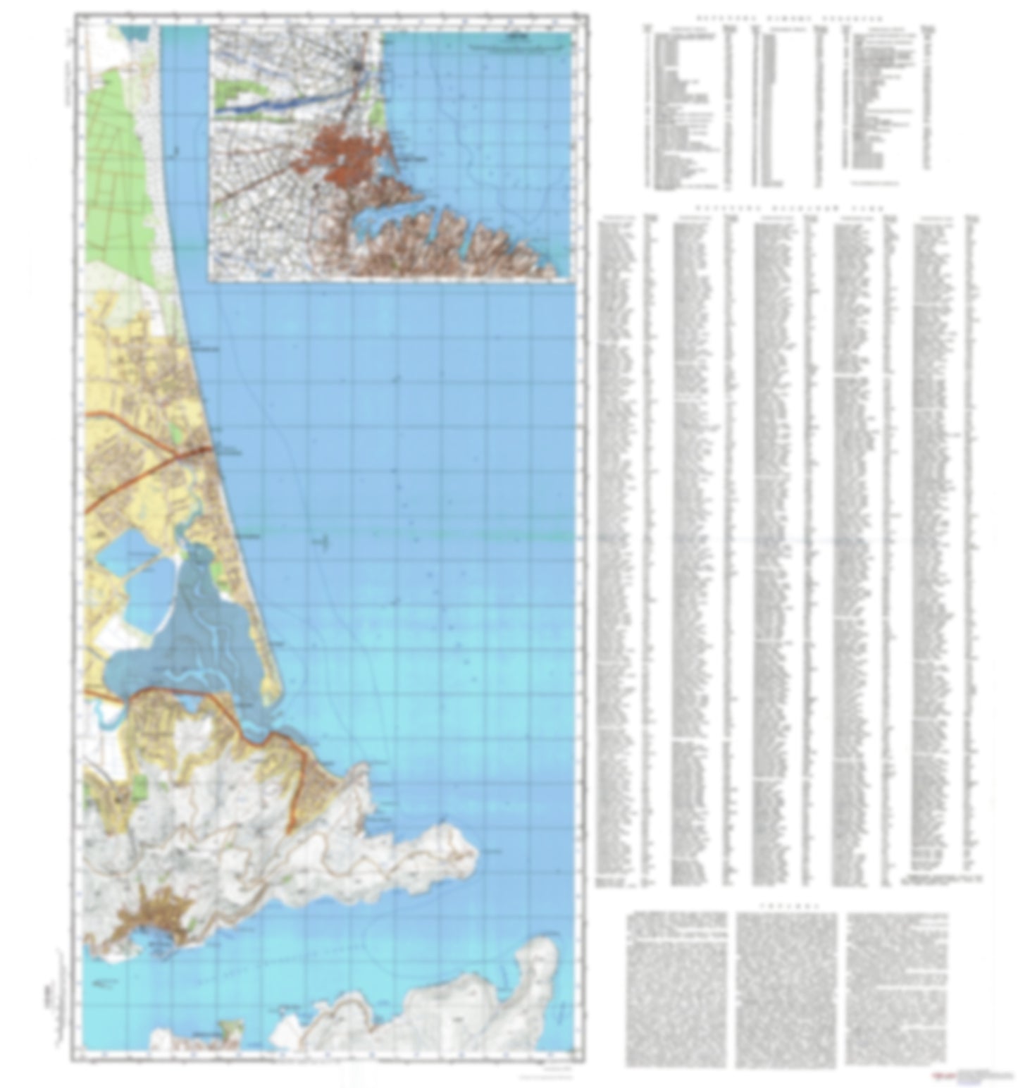
- During the Cold War and before easy access to high-resolution satellite imagery, The Soviet Military was secretly mapping the entire world. These aesthetically striking maps are beautiful down to the last detail and fantastic wall art and until now, have rarely been viewed or available to outsiders. This series has been covered by Wired Magazine and Greg Miller in his book, "All Over the Map: A Cartographic Odyssey". This map is part of the Soviet City Plans Series presented by East View, which has the largest collection of Soviet Military City Plans in the world. The Soviet Military City Plan(s) of Christchurch 2 (New Zealand) is one in a series of highly detailed topographic city maps developed by the USSR Ministry of Defense during the Cold War era. These collectable, high resolution print-on-demand editions are delivered on premium, acid-free, matte paper. This item is sheet number 2 in a set of 2 sheet(s) for Christchurch Populated Places: Clifton, Ferrymead, Lyttelton, Lyttelton, Sumner Parks and Reservations: Adderley Head Scenic Reserve, Buckleys Bay Scenic Reserve, Jollies Bush Scenic Reserve, Lyttelton Scenic Reserve, Mt Cavendish Scenic Reserve, Pukerauaruhe Island Recreation Reserve, Rat Island Recreation Reserve, Tauhinu-korokio Scenic Reserve Landmarks and Natural Features: Adderley Head, Awaroa / Godley Head, Battery Point, Bottle Lake Forest, Giants Nose, Moki Point, Mount Pleasant, Officers Point, Pukerauaruhe, Ripapa Island, Sticking Point, Stoddart Point, Sumner Head, Tapoa / Erskine Point, Tauhinukorokio / Mount Pleasant, Whitewash Head Water Bodies: Boulder Bay, Breeze Bay, Deep Gully Bay, Harris Bay, Inainatu / Pile Bay, Livingstone Bay, Lyttelton Harbour / Whakaraupo, Magazine Bay, McCormacks Bay, Mechanics Bay, Moncks Bay, Otokitoki / Gollans Bay, Sumner Bay, Taylors Mistake, Te Onepoto / Taylors Mistake, Te Pohue / Camp Bay
- Subtype: City Plan
- Language: Russian
- Publication Date: 1984-06-01
- Scale: 1:25,000
- Countries Covered: New Zealand
- MPN: CHRISTCHURCH-2
- Folded Size: N/A
- Unfolded Size: 35.9" (W) x 38.4" (H)
- Weight: 4.8 oz