USSR Ministry of Defense
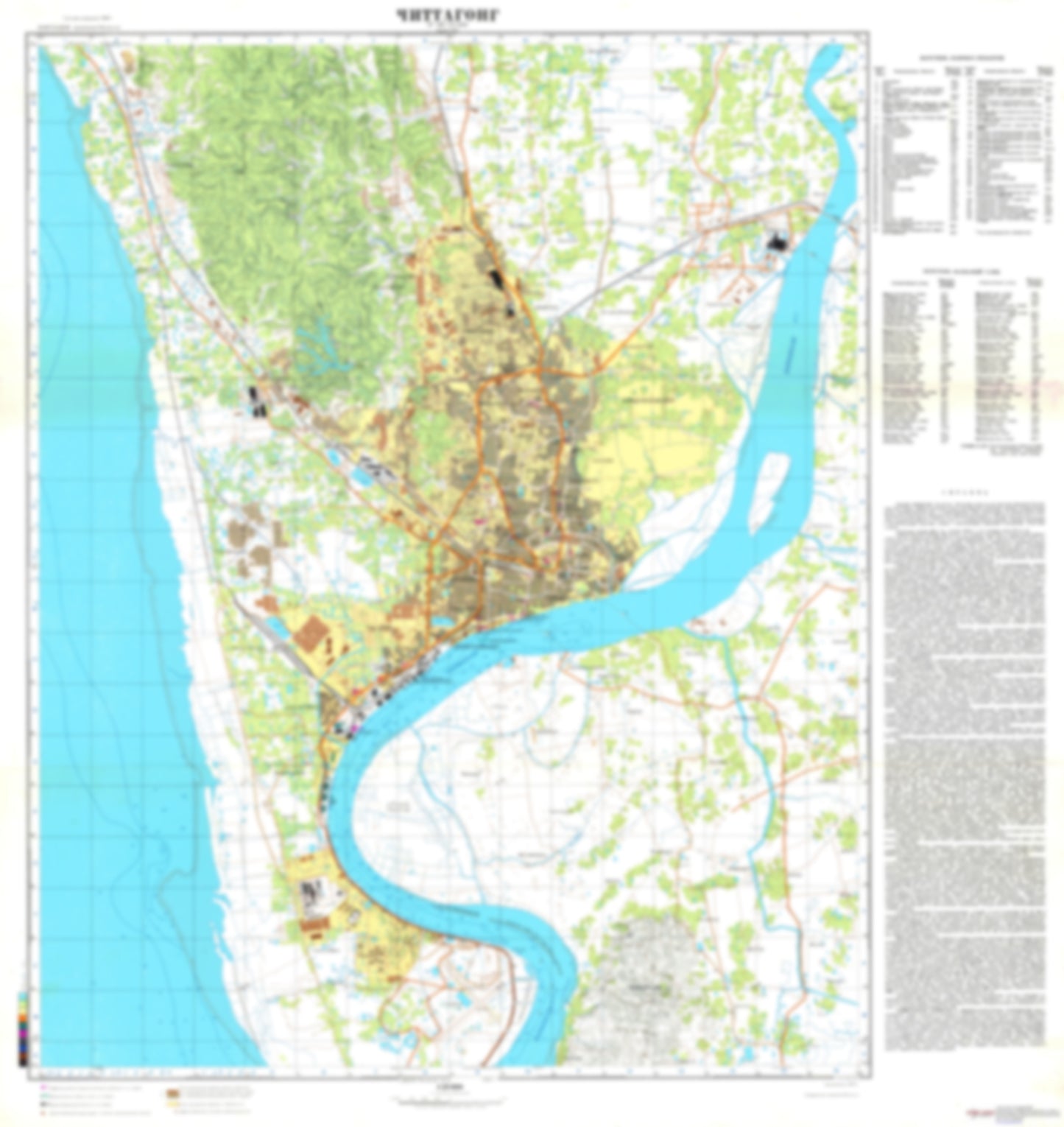
Chittagong (Bangladesh) - Soviet Military City Plans
Chittagong (Bangladesh) - Soviet Military City Plans
Regular price
$49.95 USD
Regular price
Sale price
$49.95 USD
Unit price
per
Shipping calculated at checkout.
Couldn't load pickup availability
- SKU: SUAA-CHITTAGONG-P
- During the Cold War and before easy access to high-resolution satellite imagery, The Soviet Military was secretly mapping the entire world. These aesthetically striking maps are beautiful down to the last detail and fantastic wall art and until now, have rarely been viewed or available to outsiders. This series has been covered by Wired Magazine and Greg Miller in his book, "All Over the Map: A Cartographic Odyssey". This map is part of the Soviet City Plans Series presented by East View, which has the largest collection of Soviet Military City Plans in the world. The Soviet Military City Plan(s) of Chittagong (Bangladesh) is one in a series of highly detailed topographic city maps developed by the USSR Ministry of Defense during the Cold War era. These collectable, high resolution print-on-demand editions are delivered on premium, acid-free, matte paper. This item is sheet number 1 in a set of 1 sheet(s) for Chittagong Populated Places: Bara Uthah, Bolur Char, Char Khizirpur, Char Lakshima, Char Rakha, Dakshin Madarsa, Daulatpur, Dehlipara, Kalagaon, Kalurghat, Khoajnagar, Latifpur, Mahira, Mirzanagar, Mobarak Road, Nalandab, Nasirabad, Pahartali Bazar, Sahamirpur, Shihari Chara, Sikalbaha, Uttar Burischar, Uttar Kattali, Uttar Mohara, Uttar Selimpur Landmarks and Natural Features: Bakalia Char, Chaktai, Gupta Island, Gupta Point, Lukia Island Water Bodies: Faiz Lake
- Subtype: City Plan
- Language: Russian
- Publication Date: 1980-06-01
- Scale: 1:25,000
- Countries Covered: Bangladesh
- MPN: CHITTAGONG
- Folded Size: N/A
- Unfolded Size: 32.8" (W) x 34.8" (H)
- Weight: 4.8 oz