USSR Ministry of Defense
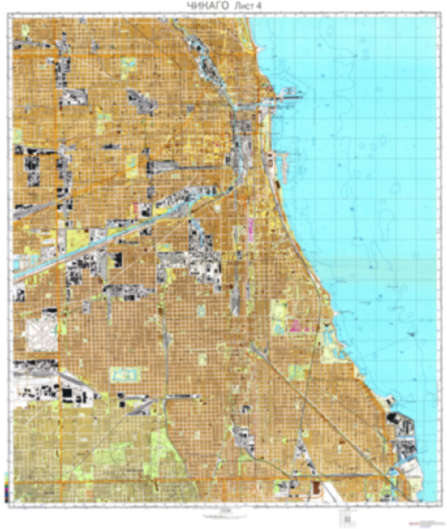
Chicago, IL 4 (USA) - Soviet Military City Plans
Chicago, IL 4 (USA) - Soviet Military City Plans
Regular price
$49.95 USD
Regular price
Sale price
$49.95 USD
Unit price
per
Shipping calculated at checkout.
Couldn't load pickup availability
- SKU: SUAA-CHICAGO4-P
- During the Cold War and before easy access to high-resolution satellite imagery, The Soviet Military was secretly mapping the entire world. These aesthetically striking maps are beautiful down to the last detail and fantastic wall art and until now, have rarely been viewed or available to outsiders. This series has been covered by Wired Magazine and Greg Miller in his book, "All Over the Map: A Cartographic Odyssey". This map is part of the Soviet City Plans Series presented by East View, which has the largest collection of Soviet Military City Plans in the world. The Soviet Military City Plan(s) of Chicago, IL 4 (USA) is one in a series of highly detailed topographic city maps developed by the USSR Ministry of Defense during the Cold War era. These collectable, high resolution print-on-demand editions are delivered on premium, acid-free, matte paper. This item is sheet number 4 in a set of 7 sheet(s) for Chicago, IL Populated Places: City of Burbank, City of Chicago, City of Hometown, Cook County, Hyde Park Township (historical), Lake Township (historical), North Township (historical), South Township (historical), Town of Cicero, Township of Cicero, West Township (historical) Landmarks and Natural Features: Calumet Park Beach, Clarke Point, Dan Ryan Woods, Fiftyninth Street Beach, Fifty-Seventh Street Beach, Forty-Ninth Street Beach, Fullerton Beach, Goose Island, Jackson Park Beach, Lincoln Park Beach (historical), Morgan Point, North Avenue Beach, Northerly Island, Oak Street Beach, Players Hill, Rainbow Park Beach, Simmons Island, Sixty-seventh Street Beach, Thirty-first Street Beach, Twelfth Street Beach, Wooded Island Water Bodies: Burnham Park Harbor, Calumet Harbor, Chicago Harbor, Columbia Basin, Cortez Basin, East Lagoon, Outer Harbor, South Lagoon, South Lagoon, West Lagoon, Yacht Harbor, Yacht Harbor
- Type: Map
- Subtype: City Plan
- Language: Russian
- Publication Date: 1982-06-01
- Scale: 1:25,000
- Regions Covered: Midwest, North America
- Countries Covered: United States
- States Covered: Illinois
- MPN: CHICAGO4
- Folded Size: N/A
- Unfolded Size: 34.9" (W) x 41.3" (H)
- Weight: 4.8 oz