USSR Ministry of Defense
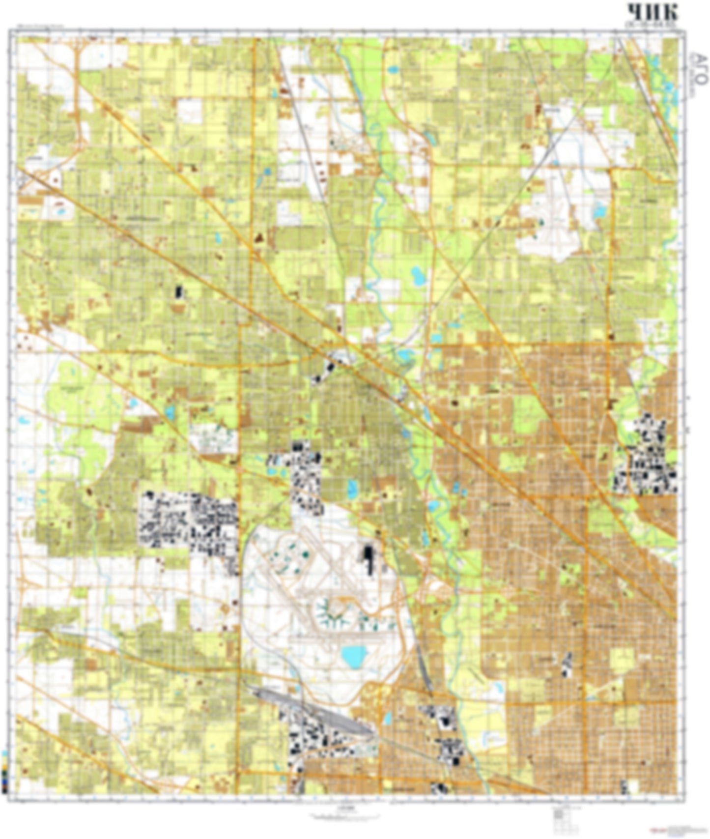
Chicago, IL 1 (USA) - Soviet Military City Plans
Chicago, IL 1 (USA) - Soviet Military City Plans
Regular price
$49.95 USD
Regular price
Sale price
$49.95 USD
Unit price
per
Shipping calculated at checkout.
Couldn't load pickup availability
- SKU: SUAA-CHICAGO1-P
- During the Cold War and before easy access to high-resolution satellite imagery, The Soviet Military was secretly mapping the entire world. These aesthetically striking maps are beautiful down to the last detail and fantastic wall art and until now, have rarely been viewed or available to outsiders. This series has been covered by Wired Magazine and Greg Miller in his book, "All Over the Map: A Cartographic Odyssey". This map is part of the Soviet City Plans Series presented by East View, which has the largest collection of Soviet Military City Plans in the world. The Soviet Military City Plan(s) of Chicago, IL 1 (USA) is one in a series of highly detailed topographic city maps developed by the USSR Ministry of Defense during the Cold War era. These collectable, high resolution print-on-demand editions are delivered on premium, acid-free, matte paper. This item is sheet number 1 in a set of 7 sheet(s) for Chicago, IL Populated Places: City of Des Plaines, City of Park Ridge, City of Prospect Heights, City of Rolling Meadows, City of Wood Dale, Township of Addison, Township of Elk Grove, Township of Leyden, Township of Maine, Township of Northfield, Township of Norwood Park, Township of Wheeling Military and Defense: Colonel P Schulstad United States Army Reserve Center Parks and Reservations: Elk Pasture, Ned Brown Meadow Landmarks and Natural Features: Algonquin Woods Water Bodies: Axehead Lake, Beck Lake, Belleau Lake, Big Bend Lake, Busse Lake, Busse Woods Reservoir, Citation Lake, Doughnut Lake, Forest Lake, Lake Cosman, Lake Irene, Lake Mary Anne, Lake O'Hare, Lake Opeka, Lake Shermerville, Murphy Lake, North Pool, Park Lake, Peterson Lake, Shagbark Lake, Skokie Lagoons, South Pool, Virginia Lake
- Type: Map
- Subtype: City Plan
- Language: Russian
- Publication Date: 1982-06-01
- Scale: 1:25,000
- Regions Covered: Midwest, North America
- Countries Covered: United States
- States Covered: Illinois
- MPN: CHICAGO1
- Folded Size: N/A
- Unfolded Size: 35.5" (W) x 42" (H)
- Weight: 4.8 oz