USSR Ministry of Defense
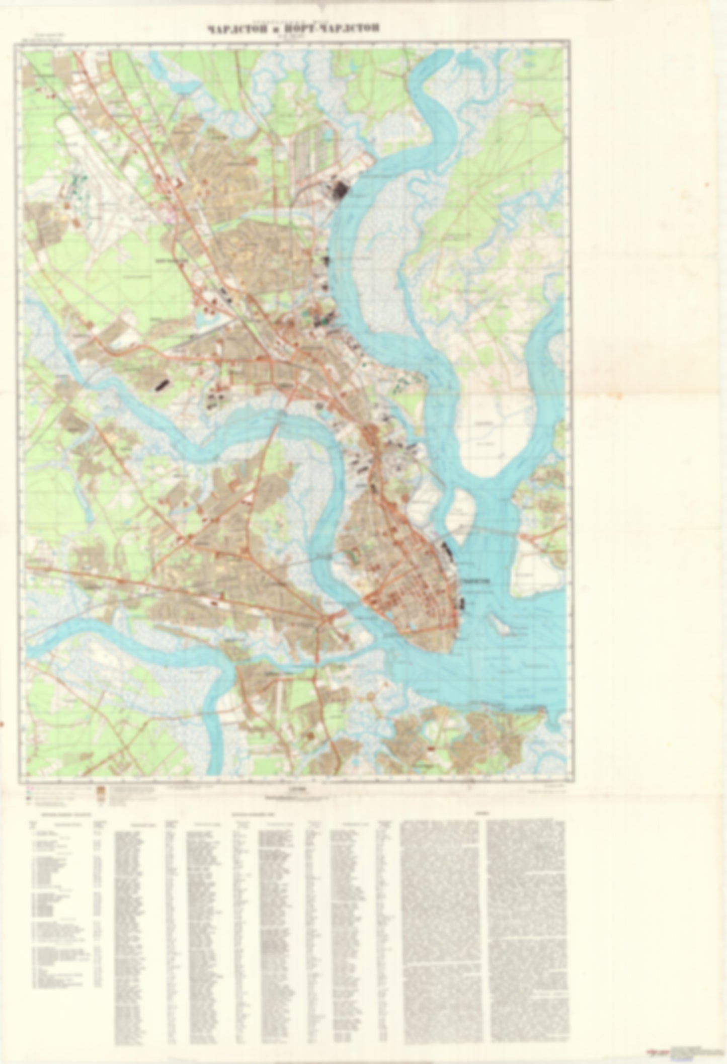
Charleston and North Charleston, SC (USA) - Soviet Military City Plans
Charleston and North Charleston, SC (USA) - Soviet Military City Plans
Regular price
$49.95 USD
Regular price
Sale price
$49.95 USD
Unit price
per
Shipping calculated at checkout.
Couldn't load pickup availability
- SKU: SUAA-CHARLESTON-P
- During the Cold War and before easy access to high-resolution satellite imagery, The Soviet Military was secretly mapping the entire world. These aesthetically striking maps are beautiful down to the last detail and fantastic wall art and until now, have rarely been viewed or available to outsiders. This series has been covered by Wired Magazine and Greg Miller in his book, "All Over the Map: A Cartographic Odyssey". This map is part of the Soviet City Plans Series presented by East View, which has the largest collection of Soviet Military City Plans in the world. The Soviet Military City Plan(s) of Charleston and North Charleston, SC (USA) is one in a series of highly detailed topographic city maps developed by the USSR Ministry of Defense during the Cold War era. These collectable, high resolution print-on-demand editions are delivered on premium, acid-free, matte paper. This item is sheet number 1 in a set of 1 sheet(s) for Charleston and North Charleston, SC Populated Places: Charleston Central Division, Charleston County, City of Charleston, City of Hanahan, North Charleston Division, West Ashley Division Military and Defense: Charleston Air Force Base, Charleston Naval Shipyard, Coast Guard Base Charleston, Naval Hospital Charleston Parks and Reservations: Accabee Flats Landmarks and Natural Features: Albemarle Point, Buzzards Roost Point, Daniel Island, Drum Island, Duck Island, East Marsh Island, Hobcaw Point, Hog Island, Oyster Point, Patriots Point, Plum Island, Remley Point, Shutes Folly Island, Snow Point, Thomas Island, West Marsh Island, Woods Point Water Bodies: Back Slack Reach, Bennis Reach, Charleston Harbor, Colonial Lake, Cowhea Reach, Custom House Reach, Daniel Island Reach, Drum Island Reach, Duck Island Channel, Elliott Cut, Folly Island Channel, Hog Island Reach, Horse Reach, Navy Yard Reach, Rebellion Reach, Slack Reach, South Channel, Town Creek, Town Creek Lower Reach, Town Creek Upper Reach
- Subtype: City Plan
- Language: Russian
- Publication Date: 1977-06-01
- Scale: 1:25,000
- Countries Covered: United States
- MPN: CHARLESTON
- Folded Size: N/A
- Unfolded Size: 36.1" (W) x 52.8" (H)
- Weight: 4.8 oz