Fishing Hot Spots
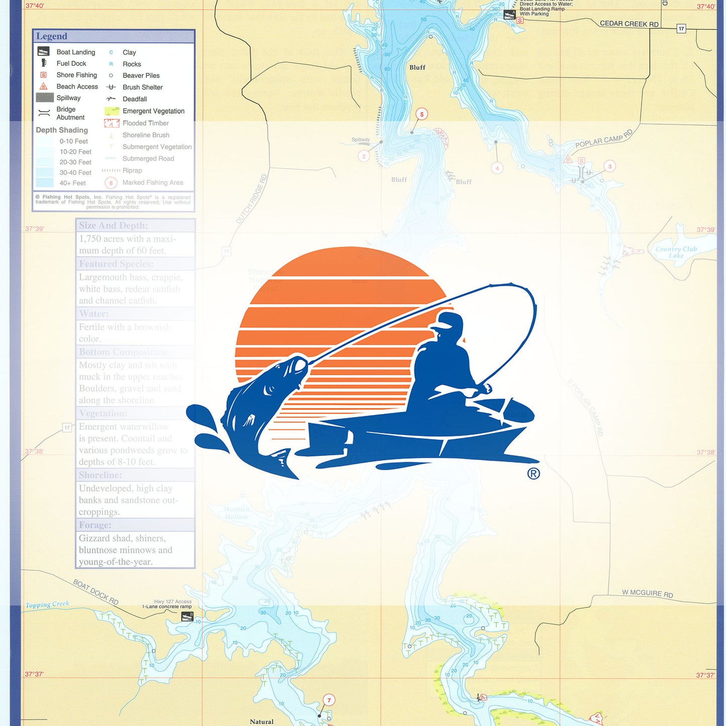
Cedar Lake Fishing Map
Cedar Lake Fishing Map
Regular price
$9.95 USD
Regular price
Sale price
$9.95 USD
Unit price
per
Shipping calculated at checkout.
Couldn't load pickup availability
- SKU: FHS_CEDAR_LAKE_
- Saltwater ChartSitting in the Gulf of Mexico, the area is made up of more than 100 islands. The shallow, surrounding waters provide habitat for hundreds of species of common and exotic birds, fish and other animals. Fish for largemouth bass in the freshwater. The brackish and Gulf waters offer redfish and trout. Numerousinshore, rocky areas hold sheepshead, mangrove snapper, grouper and cobia. Several inshore and offshore reefs and hardbottom areas give up grouper, Spanish and king mackerel, snapper, sheepshead, jacks and more. Featured Species: Black Drum, Cobia, Crevalle Jack, Gag Grouper, Gray Snapper, King Mackerel, Red Drum, Sheepshead, Spanish Mackerel, Spotted Seatrout and Tarpon Map Features: Tips and Techniques for Featured Species GPS Information 4Access Locations Indicated 47Proven Fishing Areas Marked Area Marina Information Artificial Reefs Indicated with GPS (if applicable) Covers coast between Waccasassa Bay to Shired Island Area Guide:
- Type: Folded Map
- Subtype: Fishing
- Language: English
- Regions Covered: Midwest, North America
- Countries Covered: United States
- States Covered: Illinois
- UPC: 071365901844
- MPN: G184
- Folded Size: 6" (W) x 9" (H)
- Unfolded Size: 12" (W) x 18" (H)
- Weight: 2 oz