Raven Maps
Caribbean Sea Elevation Tints Fine Art Print Map
Caribbean Sea Elevation Tints Fine Art Print Map
Couldn't load pickup availability
- SKU: PODRP_CARIB_ELEV_36X24_WA
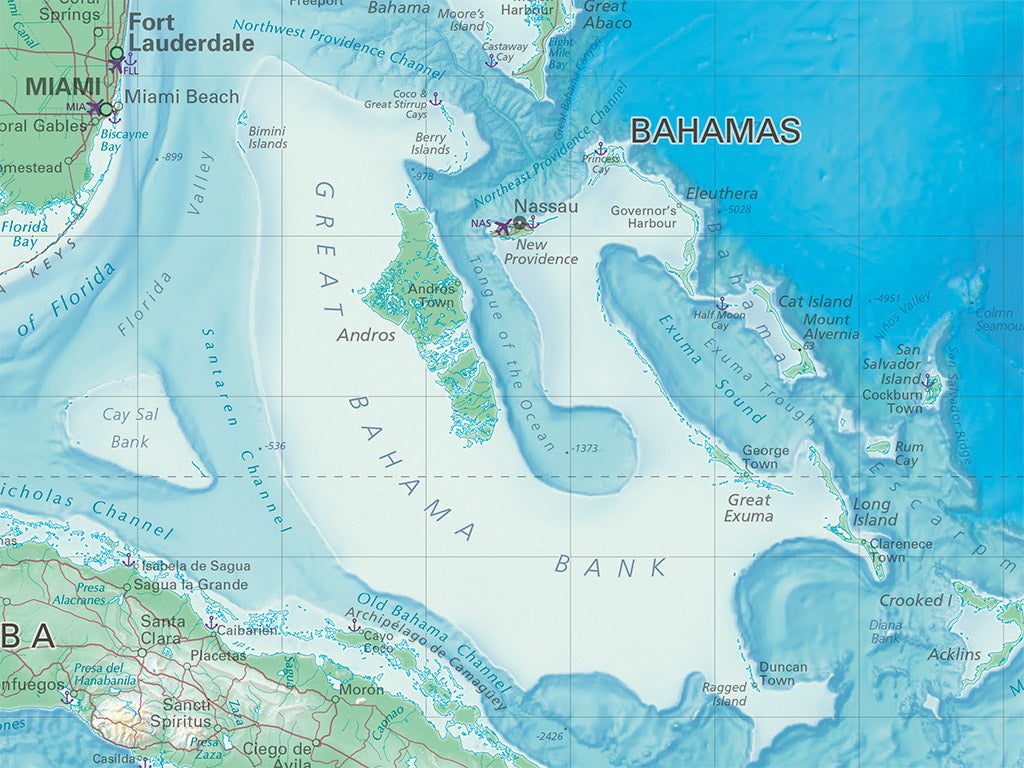
Explore the spectacular array of banks, trenches, and basins that lie beneath the surface of the Caribbean Sea. This map combines vivid bathymetric tints with a carefully constructed shaded relief to illustrate the varied landscapes hidden below the Caribbean's azure waters. The landscapes of the Antilles and the Americas frame the sea, with hypsometric tinting on land to illustrate elevations above sea level, contrasting the highest, snowcapped peaks with the deepest and darkest depths of Cayman and Puerto Rico Trenches. With nearly 1,000 hand-placed labels for countries, cities, geographic features, and depths, this map is both a detailed reference for the region and a beautiful rendering of its natural beauty.
Our Caribbean Sea elevation map is available in two standard sizes: 36x24"" (1:4,100,000) and 48x32"" (1:3,075,000).
- Type: Flat Map
- Subtype: Wall Art
- Language: English
- Scale: 1:4,100,000
- Regions Covered: Caribbean Sea, North America
- UPC: 767020011088
- MPN: PODRP_CARIB_ELEV
- Folded Size: N/A
- Unfolded Size: 36" (W) x 24" (H)
- Finish: Regular Paper