Raven Maps
Canyonlands National Park Landscape Fine Art Print Map
Canyonlands National Park Landscape Fine Art Print Map
Couldn't load pickup availability
- SKU: PODRP_CANYON_LS_16X24_WA
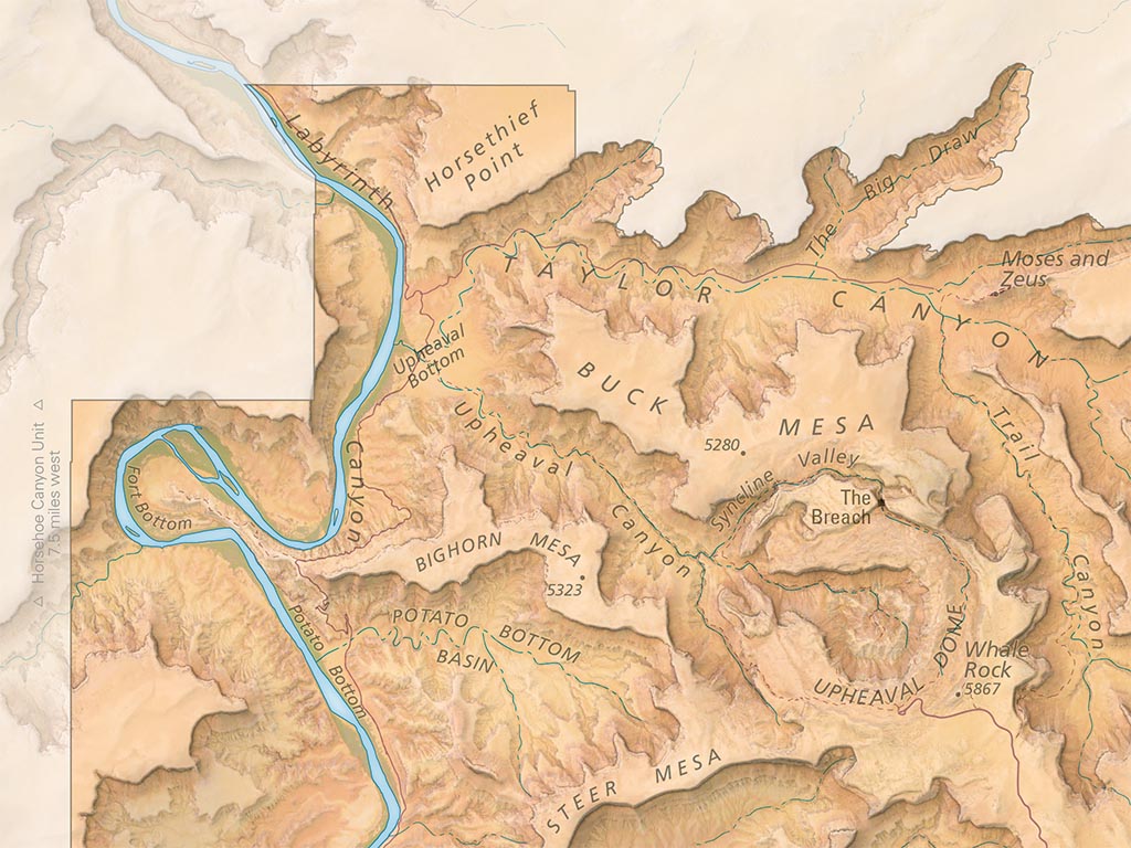
This map showcases the grand collection of landscapes that surrounds the confluence of the Colorado River and the Green River, from Island in the Sky to The Maze and The Needles. The natural colors of the landscape pop off the page courtesy of a vibrant color palette derived from satellite imagery that renders the park in all its red rock glory. Shaded relief showcases the topography with added texture to highlight the complex terrain, all complimented by hand-placed labels for canyons, buttes, mesas, and rivers. Roads and trails are shown along with major points of interest within the park, helping to orient the viewer and spark memories of previous adventures in Canyonlands. Beyond the park's boundaries, a softer shaded relief hints at the surrounding landscape. Roads and gateway communities are illustrated with faded hues, providing geographic context for Canyonlands without distracting from the park itself.
Our Canyonlands National Park landscape map is available in two standard sizes: 24x36"" (1:85,000) and 16x24"" (1:127,500).
- Type: Flat Map
- Subtype: Wall Art
- Language: English
- Scale: 1:127,500
- Regions Covered: North America, Western U.S.
- Countries Covered: United States
- States Covered: Utah
- UPC: 767020011064
- MPN: PODRP_CANYON_ELEV
- Folded Size: N/A
- Unfolded Size: 16" (W) x 24" (H)
- Finish: Regular Paper