Fish-n-Map Company
Campbell River to Port Hardy Fishing Ma
Campbell River to Port Hardy Fishing Ma
Couldn't load pickup availability
- SKU: FNM_CAM_PHA_20
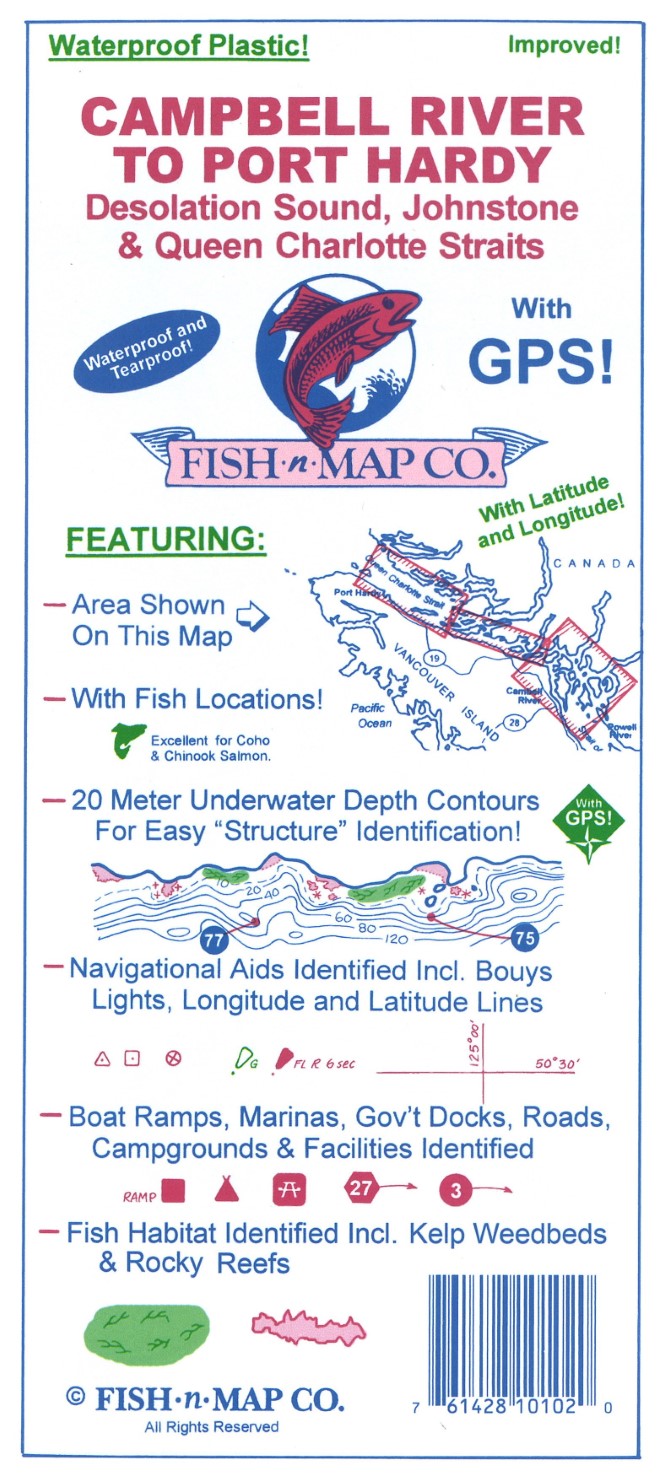
Fish-N-Map Company underwater topography maps are printed on a waterproof, tear-resistant material and are folded to 9" x 4". When opened, each map is approximately 3' x 2' in size and is printed on both sides. These maps feature waterproof plastic "paper"; underwater depth contours; fish locations; latitude and longitude for GPS; often multiple lakes on one map; boat ramps; recreational facilities; and much more.
Updated June 2020
Additions and Improvements:
• Added additional weed and kelp beds from photo data
• Added additional longitude and latitude grids, improving the grid intervals from 10' to 5'.
• Updated the GPS coordinates
• Updated facilities
• Added an additional color to the map – green
FEATURES:
2-sided waterproof, tear-resistant map which folds to 9" x 4" and unfolds to 3'x 2'
20-meter underwater depth contours
Fish habitat identified including kelp weedbeds and rocky reefs
Fishing Locations
Numerous GPS Coordinates
Navigational aids including bouys, lights, latitude and longitude grids
Boat ramps, marinas, government docks, roads, campgrounds and facilities identified
MADE IN THE U.S.A.- Type: Folded Map
- Subtype: Fishing
- Language: English
- Publication Date: 2020-06-01
- Scale: Scale not provided
- Regions Covered: North America
- Countries Covered: Canada
- States Covered: British Columbia
- UPC: 761428101020
- Folded Size: 4" (W) x 9" (H)
- Unfolded Size: 36" (W) x 24" (H)
- Weight: 2.8 oz