USSR Ministry of Defense
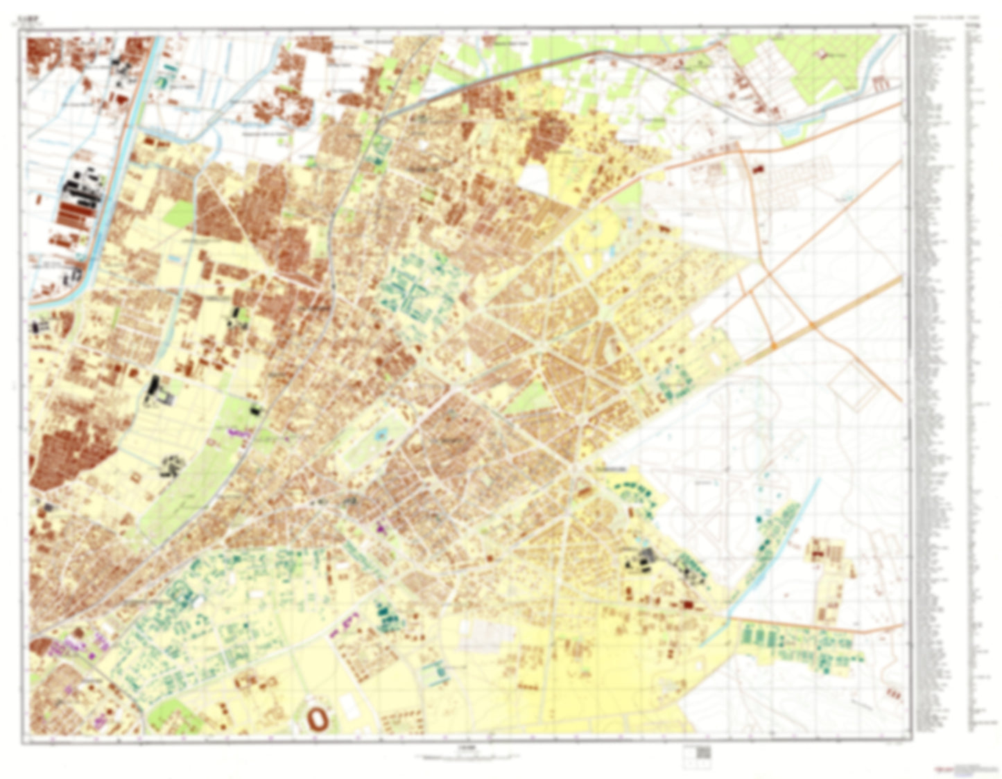
Cairo 2 (Egypt) - Soviet Military City Plans
Cairo 2 (Egypt) - Soviet Military City Plans
Regular price
$49.95 USD
Regular price
Sale price
$49.95 USD
Unit price
per
Shipping calculated at checkout.
Couldn't load pickup availability
- SKU: SUAA-CAIRO2-P
- During the Cold War and before easy access to high-resolution satellite imagery, The Soviet Military was secretly mapping the entire world. These aesthetically striking maps are beautiful down to the last detail and fantastic wall art and until now, have rarely been viewed or available to outsiders. This series has been covered by Wired Magazine and Greg Miller in his book, "All Over the Map: A Cartographic Odyssey". This map is part of the Soviet City Plans Series presented by East View, which has the largest collection of Soviet Military City Plans in the world. The Soviet Military City Plan(s) of Cairo 2 (Egypt) is one in a series of highly detailed topographic city maps developed by the USSR Ministry of Defense during the Cold War era. These collectable, high resolution print-on-demand editions are delivered on premium, acid-free, matte paper. This item is sheet number 2 in a set of 4 sheet(s) for Cairo Populated Places: Al Amiriyah, Kafr az Zahra', Nazlat Tall al Hisn Military and Defense: Almaza Air Force Base Parks and Reservations: 'Arab al Hisn, Banurama Sittat Uktubar, Hada'iq al Wayli, Hadiqat al Mayriland, Hadiqat Bin Sindar, Hadiqat Sittat Uktubar, Malahi Sindibad Landmarks and Natural Features: Al Kulliyah al Harbiyah, Al Ma'had al 'Ali as sina'i at Tijari, Jami'At 'Ayn Shams, Kulliyat al Handasah wa at Tiknulujiya, Kulliyat at Tarbiyah, Ma'had as Sikritariyah
- Subtype: City Plan
- Language: Russian
- Publication Date: 1972-06-01
- Scale: 1:10,000
- Countries Covered: Egypt
- MPN: CAIRO2
- Folded Size: N/A
- Unfolded Size: 45.2" (W) x 35.1" (H)
- Weight: 4.8 oz