British Antarctic Survey
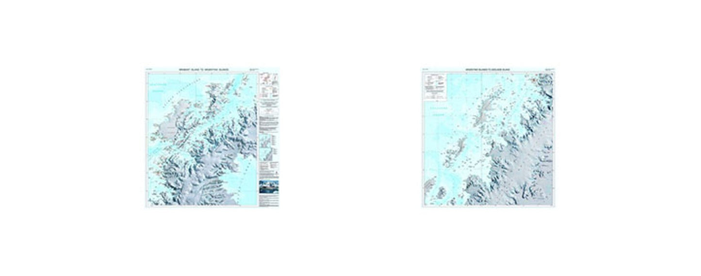
Brabant Island to Adelaide Island Map
Brabant Island to Adelaide Island Map
Regular price
$24.95 USD
Regular price
Sale price
$24.95 USD
Unit price
per
Shipping calculated at checkout.
Couldn't load pickup availability
- SKU: BAS_BRABANT_IS_ADE_IS_WA_17
- The map covers the area of the west coast of the Antarctic Peninsula between Brabant Island and Adelaide Island, including: Gerlache Strait; Lemaire Channel; Palmer Station; Vernadsky Station; Grandidier Channel; Crystal Sound and Port Lockroy Historic Site. It also covers part of the east coast including Exasperation Inlet and Crane Glacier. Side A covers from Brabant Island to Argentine Island and side B covers Argentine Island to Adelaide Island. It connects to map BAS/UKAHT 3 to give full coverage of the northern Antarctic Peninsula north of Adelaide Island.The map shows topographic detail with a Landsat 8 satellite image mosaic backdrop. It includes coastline; elevation information as contours and selected mountain summit heights; UK place names; scientific research stations; Historic Sites and Monuments. (HSMs) and Antarctic Specially Protected Areas (ASPAs).
- Type: Wall Map
- Subtype: Travel
- Language: English
- Publication Date: 2017-06-01
- Scale: 1:250,000
- Regions Covered: Antarctica
- Countries Covered: Antarctica
- ISBN: 9780856651977
- Folded Size: 13.5" (W) x 22.5" (H)
- Unfolded Size: 88" (W) x 84" (H)