Latitude 40° Maps
Boulder – Nederland Trails Hiking Map
Boulder – Nederland Trails Hiking Map
Regular price
$14.95 USD
Regular price
Sale price
$14.95 USD
Unit price
per
Shipping calculated at checkout.
Low stock
Couldn't load pickup availability
- SKU: LAT40_BOU_NED_23
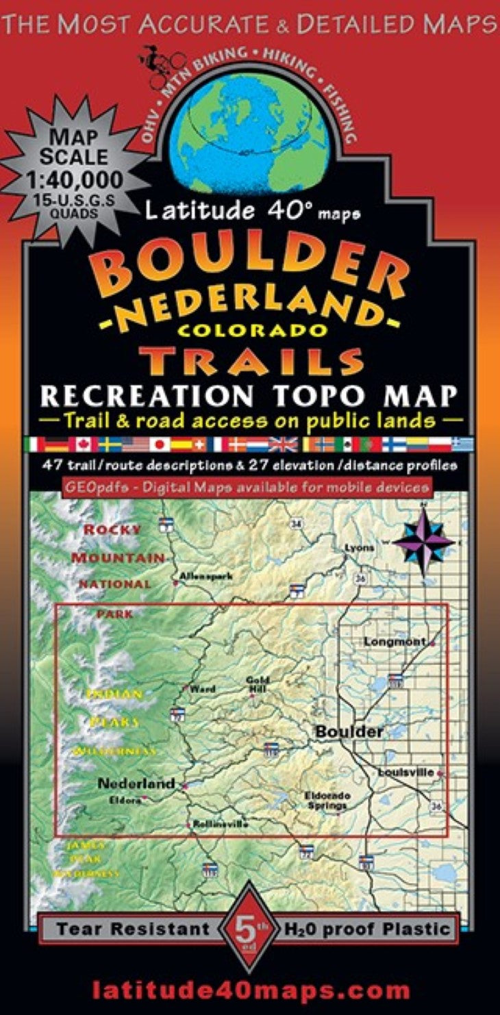
- Popular recreation area in Boulder County. All public access trails and roads are highlighted for all user groups. City of Boulder Mtn. Parks and Open Space, Boulder County Open Space and Forest Service system routes are shown as well as the extremely popular Brainard Lake Recreation Area and West Magnolia Trail System located SW of Nederland. Two-sided map covers 18 miles north to south from Saint Vrain Mtn. on the southern boundary of Rocky Mtn. NP, south to Rollins Pass Rd. and the small town of Rollinsville. East to west for 30 miles from N. 95th St., west to Rollins Pass on the Cont. Divide. The eastern access gateway to Indian Peaks Wilderness, and the Boulder foothills east and west of the Peak to Peak Scenic Highway. From the plains, mesas and flatirons of Boulder, up the canyons through the foothills, to the higher elevation montane-subalpine below treeline, and eventually traversing the alpine tundra to the Continental Divide. Trailheads, campgrounds, dispersed camping, picnic areas, day use areas, parking/pullouts, mtn. huts, cabins, warming huts and yurts, locations of mines, adits or caves, remnants of old mills and mining camps, ghost towns, old historic RR grades and trestles and historical townsites. Points of interest, special geologic areas and scenic viewpoints/overlooks. As well as winter XC skiing trails and Boulder’s paved recreation paths and road routes. 48 trail/route descriptions and 20 elevation/distance profiles suggest appropriate routes for all recreationists. Mileage between junctions/route difficulty ratings. Reference our regional map, Front Range Trails to connect and follow all routes that extend beyond this maps boundaries.
- Type: Folded Map
- Subtype: Hiking
- Language: English
- Publication Date: 2023-06-01
- Scale: 1:40,000
- Regions Covered: Central U.S., North America
- Countries Covered: United States
- States Covered: Colorado
- ISBN: 9781879866539
- Folded Size: 4" (W) x 8" (H)
- Unfolded Size: 25" (W) x 39" (H)
- Weight: 3 oz