Latitude 40° Maps
Boulder County Trails Hiking Map
Boulder County Trails Hiking Map
Regular price
$14.95 USD
Regular price
Sale price
$14.95 USD
Unit price
per
Shipping calculated at checkout.
Low stock
Couldn't load pickup availability
- SKU: LAT40_BOU_CO_23
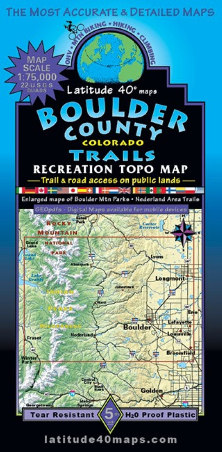
- The first Latitude 40°/Zia Trail map was originally introduced in 1989 as the Boulder County Mountain Bike map - 37 years,11 editions and hundreds of updates and revisions later it remains the most definitive, well recognized, accurate and detailed public access trail and road map for all recreationists in Boulder County. Two-sided, regional map on the frontside of Boulder County and beyond, covers 29 miles north to south from Longs Peak CG (off State Hwy. 72), south to Rogers Pass on the Continental Divide. East to west for 41 miles from US Hwy. 287 (which runs N-S through Longmont and Lafayette), west over the Cont. Divide to the towns of Grand Lake, Frazer and Winter Park. The back-side features 2 enlarged inset maps (1"= 0.4 miles). One of the area surrounding Boulder with all trails in Boulder Mtn. Parks and Open Space and Boulder Co. Open Space. The other inset shows the town of Nederland (18 miles west of Boulder) and surrounding area. All public access trails and roads are highlighted for all user groups. 40 trail/route descriptions with elevation/distance profiles. The regional map includes Indian Peaks Wilderness, Southern Rocky Mountain NP, James Peak Wilderness, Boulder Mountain Parks and Open Space, Boulder County Open Space, Eldorado Canyon State Park and dozens of Recreation Areas and Preserves. Trailheads, campgrounds, dispersed camping, day use areas, picnic areas, mtn. huts and cabins and historical townsites. As well as winter XC skiing trails and Boulder’s paved recreation pathways and road routes. Reference our regional map, Front Range Trails to connect and follow all routes that extend beyond this maps boundaries.
- Type: Folded Map
- Subtype: Hiking
- Language: English
- Publication Date: 2023-06-01
- Scale: 1:75,000
- Regions Covered: Central U.S., North America
- Countries Covered: United States
- States Covered: Colorado
- ISBN: 9781879866546
- Folded Size: 4" (W) x 8" (H)
- Unfolded Size: 25" (W) x 39" (H)
- Weight: 3 oz