USSR Ministry of Defense
Boston, MA 4 (USA) - Soviet Military City Plans
Boston, MA 4 (USA) - Soviet Military City Plans
Regular price
$49.95 USD
Regular price
Sale price
$49.95 USD
Unit price
per
Shipping calculated at checkout.
Couldn't load pickup availability
- SKU: SUAA-BOSTON4-P
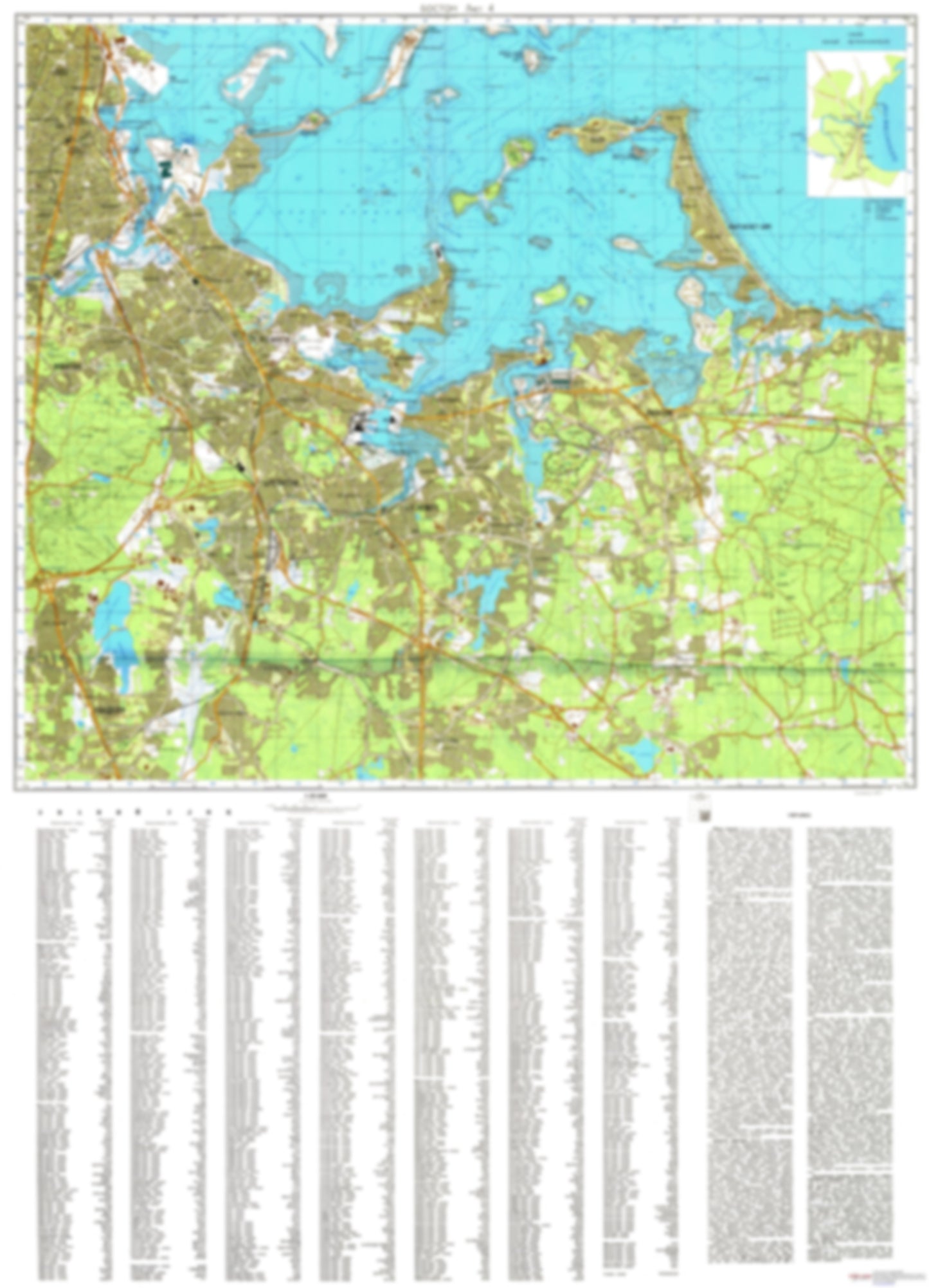
- During the Cold War and before easy access to high-resolution satellite imagery, The Soviet Military was secretly mapping the entire world. These aesthetically striking maps are beautiful down to the last detail and fantastic wall art and until now, have rarely been viewed or available to outsiders. This series has been covered by Wired Magazine and Greg Miller in his book, "All Over the Map: A Cartographic Odyssey". This map is part of the Soviet City Plans Series presented by East View, which has the largest collection of Soviet Military City Plans in the world. The Soviet Military City Plan(s) of Boston, MA 4 (USA) is one in a series of highly detailed topographic city maps developed by the USSR Ministry of Defense during the Cold War era. These collectable, high resolution print-on-demand editions are delivered on premium, acid-free, matte paper. This item is sheet number 4 in a set of 4 sheet(s) for Boston, MA Populated Places: City of Braintree Town, City of Quincy, City of Randolph Town, City of Weymouth Town, Town of Hingham, Town of Hull Parks and Reservations: Broad Meadows, White Head Flats Landmarks and Natural Features: Allerton Hill, Atlantic Hill, Babel Rock, Baker Hill, Bass Point, Bass Rock, Black Rock, Black Rock Beach, Blue Hill Range, Bradley Hill, Bumkin Island, Button Island, Carson Beach, Cat Island, Center Hill, Chickatawbut Hill, Columbia Point, Commercial Point, Crescent Beach, Crow Point, Davids Island, Deer Hill, Eastern Neck, Farm Hills, Ferry Point Water Bodies: Aaron River Reservoir, Beal Cove, Blacks Creek, Blue Hills Reservoir, Broad Cove, Dorchester Bay, Echo Lake, Gulliver Creek, Hingham Harbor, Hull Bay, Lower Neck Cove, Martins Well, Mill Cove, Neponset River Reservoir, Old Harbor, Old Quincy Reservoir, Perry Cove, Savin Hill Cove, Squantum Channel, Sunset Lake, Town River, Town River Bay, Upper Neck Cove, Weymouth Back River, Wollaston Channel
- Type: Map
- Subtype: City Plan
- Language: Russian
- Publication Date: 1979-06-01
- Scale: 1:25,000
- Regions Covered: Mid-Atlantic/Northeastern U.S., North America
- Countries Covered: United States
- States Covered: Massachusetts
- MPN: BOSTON4
- Folded Size: N/A
- Unfolded Size: 34.9" (W) x 48.4" (H)
- Weight: 4.8 oz