USSR Ministry of Defense
Boston, MA 3 (USA) - Soviet Military City Plans
Boston, MA 3 (USA) - Soviet Military City Plans
Regular price
$49.95 USD
Regular price
Sale price
$49.95 USD
Unit price
per
Shipping calculated at checkout.
Couldn't load pickup availability
- SKU: SUAA-BOSTON3-P
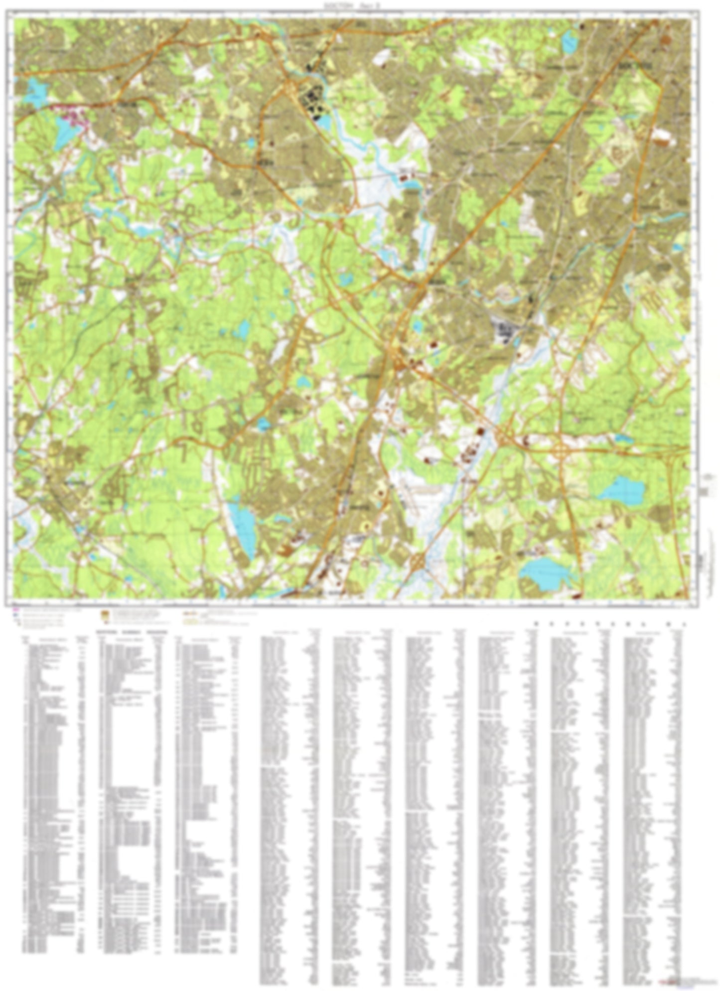
- During the Cold War and before easy access to high-resolution satellite imagery, The Soviet Military was secretly mapping the entire world. These aesthetically striking maps are beautiful down to the last detail and fantastic wall art and until now, have rarely been viewed or available to outsiders. This series has been covered by Wired Magazine and Greg Miller in his book, "All Over the Map: A Cartographic Odyssey". This map is part of the Soviet City Plans Series presented by East View, which has the largest collection of Soviet Military City Plans in the world. The Soviet Military City Plan(s) of Boston, MA 3 (USA) is one in a series of highly detailed topographic city maps developed by the USSR Ministry of Defense during the Cold War era. These collectable, high resolution print-on-demand editions are delivered on premium, acid-free, matte paper. This item is sheet number 3 in a set of 4 sheet(s) for Boston, MA Populated Places: Norfolk County, Town of Brookline, Town of Canton, Town of Dedham, Town of Dover, Town of Medfield, Town of Milton, Town of Needham, Town of Norwood, Town of Wellesley, Town of Westwood Landmarks and Natural Features: Academy Hill, Bald Knob, Bald Pate Hill, Bearberry Hill, Bellevue Hill, Birds Pond, Boyce Hill, Breeze Hill, Brush Hill, Buck Hill, Burnt Hill, Bussey Hill, Carver Hill, Castle Hill, Cat Rock, Cedar Hill, Cherry Hill, Childs Island, Devilsfoot Island, Everett Hill, Fox Hill, Great Blue Hill, Green Hill, Hancock Hill, Harvey Beach Water Bodies: Charles River Reservoir, Charles River Reservoir, Charles River Reservoir, Chickering Lake, Crystal Lake, Echo Lake, Lake Waban, Needham Reservoir, Neponset River Reservoir, Pine Tree Brook Reservoir, Pine Tree Brook Reservoir, Rosemary Lake, Sabrina Lake, Single Tree Hill Reservoir
- Type: Map
- Subtype: City Plan
- Language: Russian
- Publication Date: 1979-06-01
- Scale: 1:25,000
- Regions Covered: Mid-Atlantic/Northeastern U.S., North America
- Countries Covered: United States
- States Covered: Massachusetts
- MPN: BOSTON3
- Folded Size: N/A
- Unfolded Size: 35.2" (W) x 48.5" (H)
- Weight: 4.8 oz