Raven Maps
Black Mountains Peakscapes Elevation Panorama
Black Mountains Peakscapes Elevation Panorama
Regular price
$34.95 USD
Regular price
Sale price
$34.95 USD
Unit price
per
Shipping calculated at checkout.
Couldn't load pickup availability
- SKU: PODRP_PS_BK_MT_RED_LAM
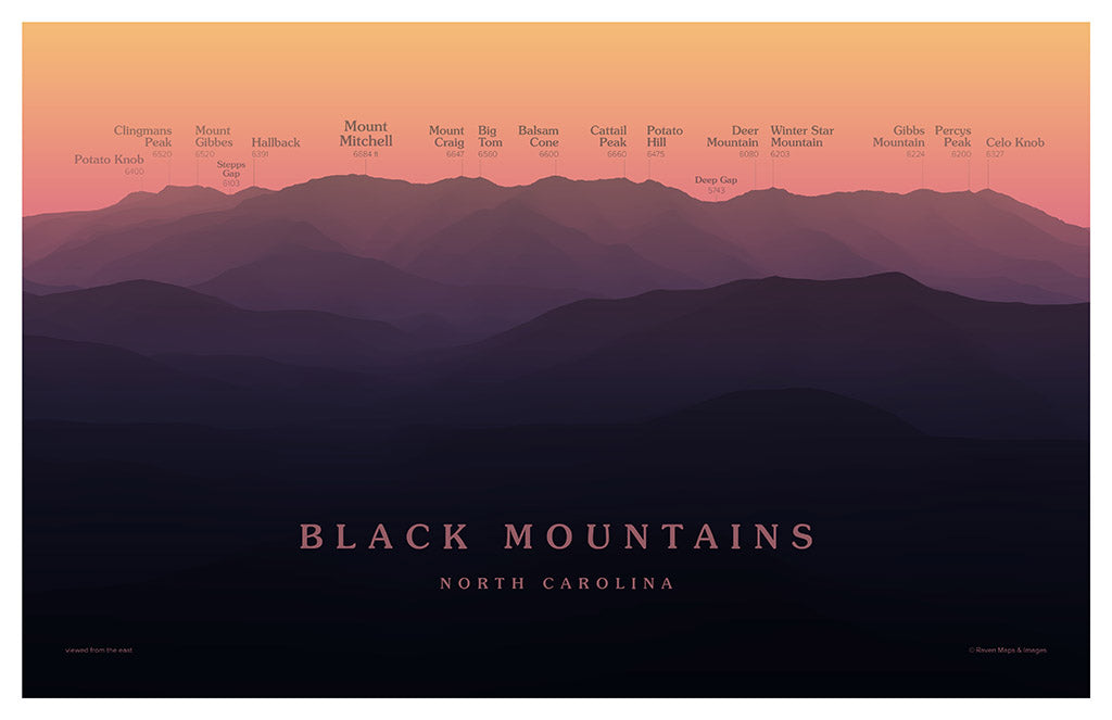
The Black Mountains rise northeast of Asheville, one of many subranges that make up the Blue Ridge Mountains. Running 15 miles north to south, the Blacks are the home of many of the loftiest peaks found in the Eastern US, including the highest: Mount Mitchell, with its summit elevation of 6684 feet above sea level.
This view, looking at the range from the east, provides a grand panorama of this exceptional range, incorporating all the high peaks that line the crest of the Black Mountains from Potato Knob to Celo Knob.
Elevations are shown in feet.
- Subtype: Wall Art
- Language: English
- Publication Date: 2025-05-01
- Regions Covered: North America, Southern U.S.
- Countries Covered: United States
- States Covered: North Carolina
- UPC: 767020005124
- Folded Size: N/A
- Unfolded Size: 17" (W) x 11" (H)
- Finish: Lamination
- Color: Red