NOAA
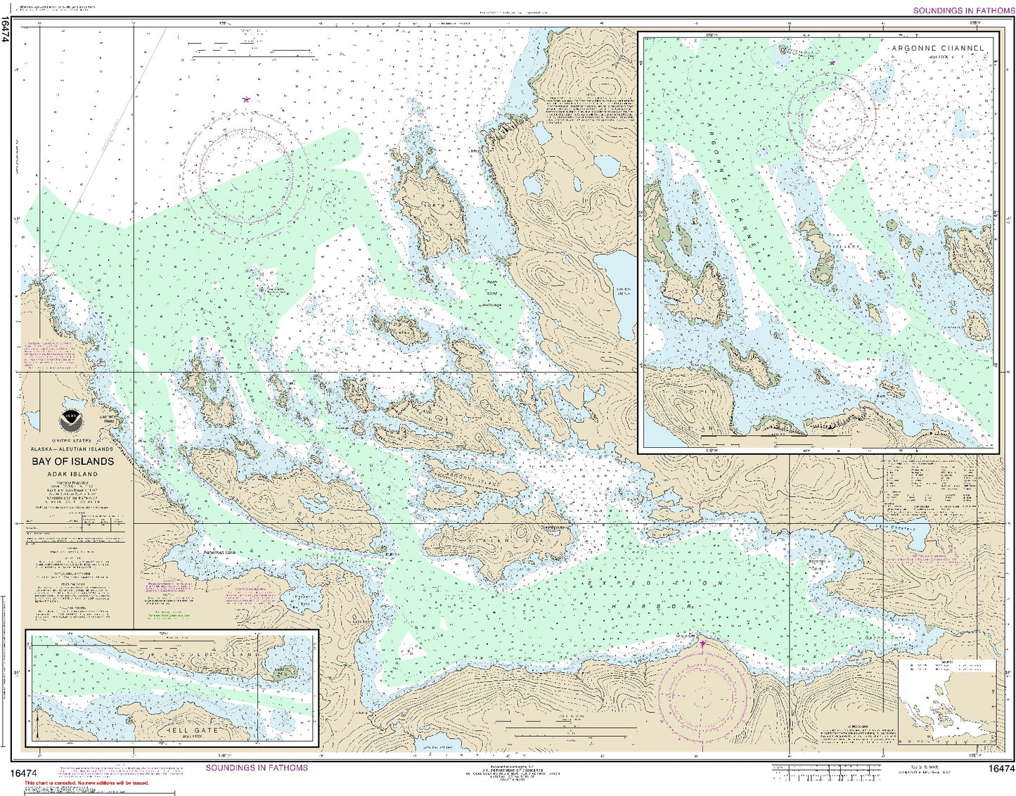
Bay of Islands (16474) by NOAA
Bay of Islands (16474) by NOAA
Regular price
$19.00 USD
Regular price
Sale price
$19.00 USD
Unit price
per
Shipping calculated at checkout.
Couldn't load pickup availability
- SKU: USAC-16474-P
- East View Map Link (EVML), a certified NOAA and NGA print on demand printer; provides mariners with up-to-date National Oceanic and Atmospheric Administration (NOAA) approved nautical charts. Our Yaquina Bay and River; Continuation of Yaquina River nautical chart (Map Index 18581) is printed using high resolution, heavy weight and acid free paper. All charts are printed with the latest Notice to Mariners (NTMs), and meet United States Coast Guard and international carriage requirements for commercial and recreational vessels. Waterproof options are also available. All NOAA nautical charts ship rolled, and are printed by East View Map Link, LLC.
- Type: Flat Map
- Subtype: General Nautical
- Language: English
- Publication Date: 2015-03-01
- Scale: 1:12,000
- Countries Covered: United States
- MPN: 16474
- Folded Size: N/A
- Unfolded Size: 41.16" (W) x 35.23" (H)