USSR Ministry of Defense
Baltimore, MD 4 (USA) - Soviet Military City Plans
Baltimore, MD 4 (USA) - Soviet Military City Plans
Regular price
$49.95 USD
Regular price
Sale price
$49.95 USD
Unit price
per
Shipping calculated at checkout.
Couldn't load pickup availability
- SKU: SUAA-BALTIMORE4-P
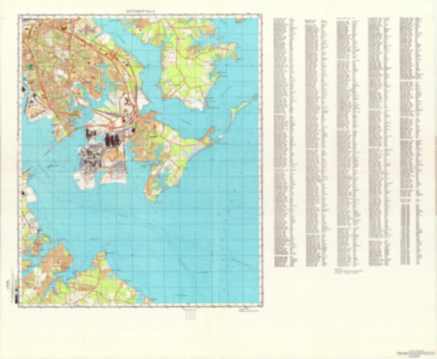
- During the Cold War and before easy access to high-resolution satellite imagery, The Soviet Military was secretly mapping the entire world. These aesthetically striking maps are beautiful down to the last detail and fantastic wall art and until now, have rarely been viewed or available to outsiders. This series has been covered by Wired Magazine and Greg Miller in his book, "All Over the Map: A Cartographic Odyssey". This map is part of the Soviet City Plans Series presented by East View, which has the largest collection of Soviet Military City Plans in the world. The Soviet Military City Plan(s) of Baltimore, MD 4 (USA) is one in a series of highly detailed topographic city maps developed by the USSR Ministry of Defense during the Cold War era. These collectable, high resolution print-on-demand editions are delivered on premium, acid-free, matte paper. This item is sheet number 4 in a set of 4 sheet(s) for Baltimore, MD Populated Places: District 12, District 15 Landmarks and Natural Features: Back River Neck, Balliston Point, Booby Island (historical), Booby Point, Cattail Point, Cedar Point, Claphams Point, Claybank Point, Coffin Point, Cox Point, Cuckold Point, Drum Point, Frankie Point, Goose Neck, Greenmarsh Point, Hart-Miller Island, Hathaway Island (historical), Hawkins Point, Hog Neck, Lloyd Point, Long Point, Lovel Point, Lynch Point, North Point, Old Landen Point Water Bodies: Back Cove, Beehive Cove, Big Burley Cove, Brewerton Channel, Clement Cove, Club Cove, Cox Creek, Cutoff Channel, Gambrill Cove, Greenhill Cove, Hawk Cove, Long Cove, Lynch Cove, Marine Channel, Nabbs Creek, Oakleigh Cove, Old Road Bay, Peachorchard Cove, Penwood Channel, Rock Creek, Schoolhouse Cove, Shallow Creek, Sparrows Point Channel, Stony Creek, Tar Cove, Wall Cove, Whites Cove
- Subtype: City Plan
- Language: Russian
- Publication Date: 1983-06-01
- Scale: 1:25,000
- Countries Covered: United States
- MPN: BALTIMORE4
- Folded Size: N/A
- Unfolded Size: 43.5" (W) x 35.7" (H)
- Weight: 4.8 oz