USSR Ministry of Defense
Baghdad 1 (Iraq) - Soviet Military City Plans
Baghdad 1 (Iraq) - Soviet Military City Plans
Regular price
$49.95 USD
Regular price
Sale price
$49.95 USD
Unit price
per
Shipping calculated at checkout.
Couldn't load pickup availability
- SKU: SUAA-BAGHDAD1-P
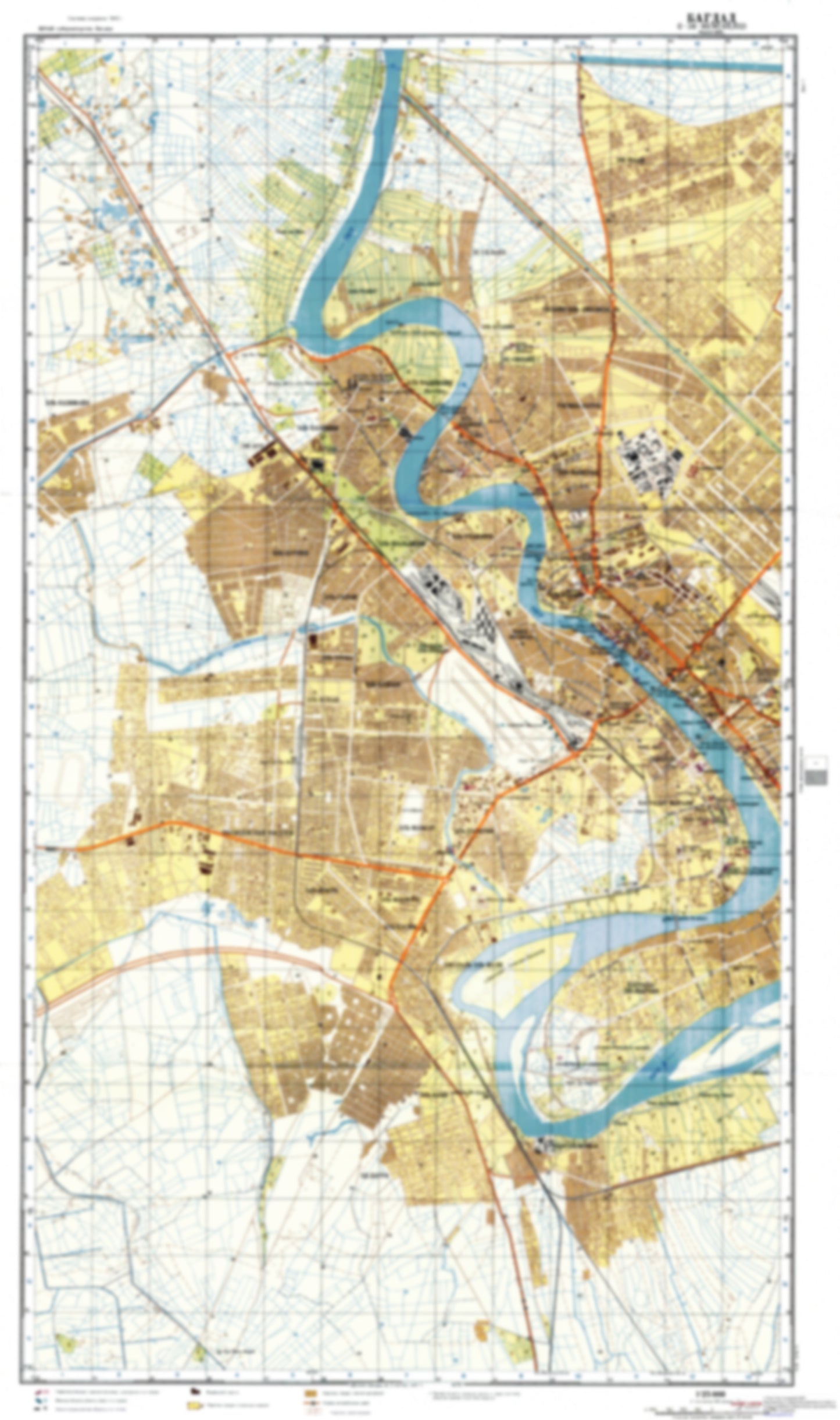
- During the Cold War and before easy access to high-resolution satellite imagery, The Soviet Military was secretly mapping the entire world. These aesthetically striking maps are beautiful down to the last detail and fantastic wall art and until now, have rarely been viewed or available to outsiders. This series has been covered by Wired Magazine and Greg Miller in his book, "All Over the Map: A Cartographic Odyssey". This map is part of the Soviet City Plans Series presented by East View, which has the largest collection of Soviet Military City Plans in the world. The Soviet Military City Plan(s) of Baghdad 1 (Iraq) is one in a series of highly detailed topographic city maps developed by the USSR Ministry of Defense during the Cold War era. These collectable, high resolution print-on-demand editions are delivered on premium, acid-free, matte paper. This item is sheet number 1 in a set of 2 sheet(s) for Baghdad Populated Places: 'Abbas al Wadi, 'Abbas Mulla 'Alwan, 'Abd al Wahid, 'Arab Jalub, albu Birghuth, As Sayyid taha', Ath Tha'Alibah, Fadil Nasif, Hasan as Suhayl, Jamal al 'Aziz, Kamil al Wazur, Mahmud al 'ud, MuHafazat Baghdad, MuHaysin al Ibrahim, Nazl Hikmat Bayk, Nazl Rashid 'Ali, Qal'At Hamid al Habash, Qaryat al 'Asifah, Qaryat al Masarah, Qaryat Jasim MuHammad Hasan, Qasim Mulla 'Alwan, Salih Hasan, Shakr Hamid al Wajab, Tall ar Rukhsah, Tall Kubayb Military and Defense: Mu'Askar Washash Parks and Reservations: Hadiqat az Zawra' Landmarks and Natural Features: Jami'At Baghdad, Jazirat Umm al Khanazir
- Subtype: City Plan
- Language: Russian
- Publication Date: 1976-06-01
- Scale: 1:25,000
- Countries Covered: Iraq
- MPN: BAGHDAD1
- Folded Size: N/A
- Unfolded Size: 23.1" (W) x 39" (H)
- Weight: 4.8 oz