Benchmark Maps
Asheville, North Carolina and The Blue Ridge Parkway Wall Map
Asheville, North Carolina and The Blue Ridge Parkway Wall Map
Regular price
$39.95 USD
Regular price
Sale price
$39.95 USD
Unit price
per
Shipping calculated at checkout.
Couldn't load pickup availability
- SKU: PODBEN_NC_ASHE_SM_LAM
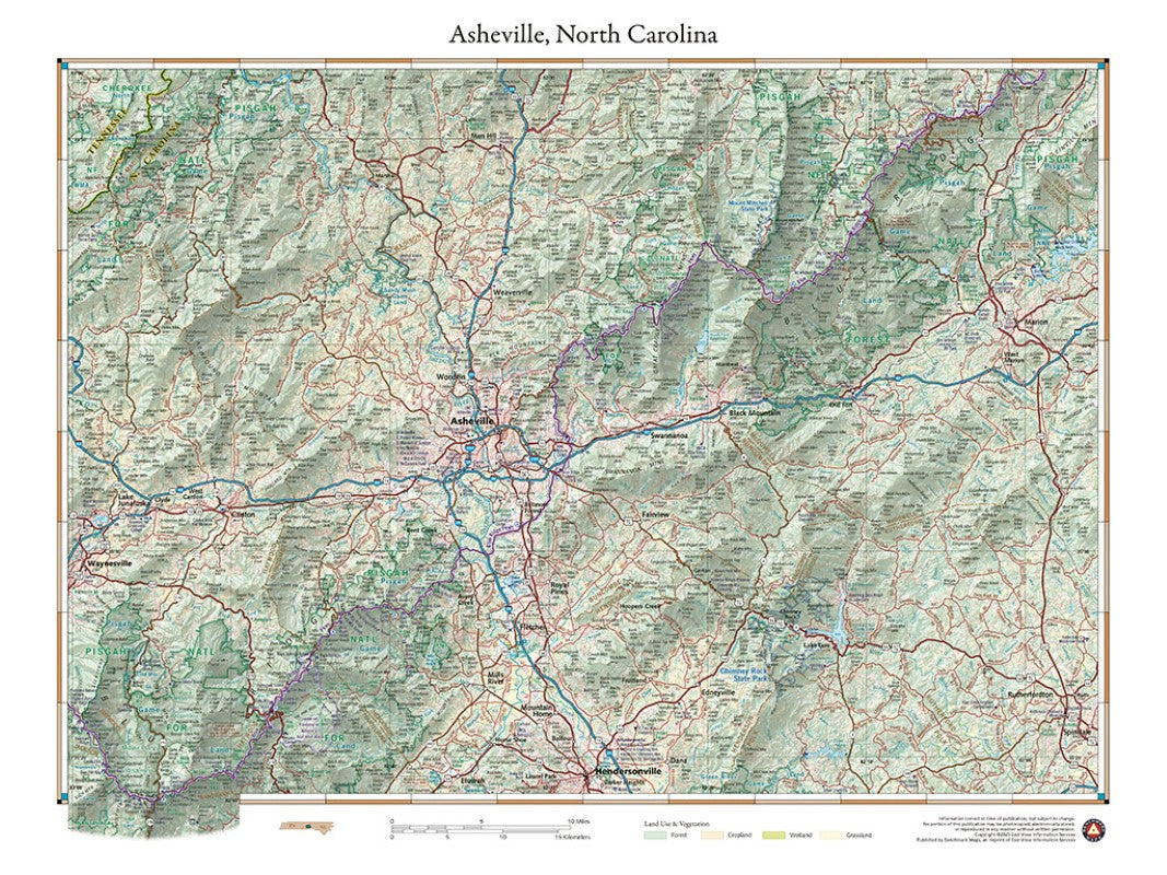
- This wall map details the terrain and public lands surrounding Asheville, North Carolina. Map features include Mt. Mitchell (highest peak in the eastern U.S.), sections of Pisgah National Forest, several of North Carolina’s state parks, and the segment of the Blue Ridge Parkway between McKinney Gap in the northeast and Richland Balsam Overlook (highest point on BRP) in the southwest.
- Type: Flat Map
- Subtype: Wall Art
- Language: English
- Publication Date: 2023-05-16
- Scale: 1:172250
- Regions Covered: North America, Southern U.S.
- Countries Covered: United States
- States Covered: North Carolina
- UPC: 767020002628
- Folded Size: N/A
- Unfolded Size: 24" (W) x 18" (H)
- Finish: Lamination