Trekking Chile
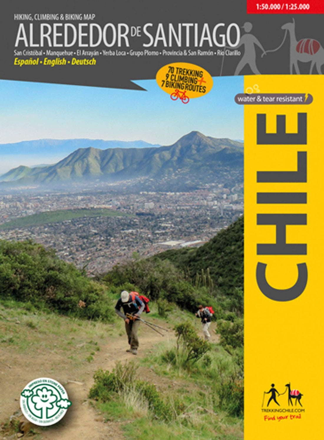
Around Santiago, Chile - Hiking, Biking, & Climbing Map
Around Santiago, Chile - Hiking, Biking, & Climbing Map
Regular price
$24.95 USD
Regular price
Sale price
$24.95 USD
Unit price
per
Shipping calculated at checkout.
Low stock
Couldn't load pickup availability
- SKU: TC_SANTIAGO_18
- The first map showing 70 hiking, 9 climbing and 7 biking routes in the immediate vicinity of Santiago de Chile, including the following areas: Cerro San Cristóbal Cordón Manquehue El Arrayán - Pochoco La Dehesa Santuario Yerba Loca, with Cerro La Paloma (4910 m) Grupo Plomo: Cerro Pintor (4180 m), Cerro Leonera (4954 m), Punta Santiago (5083 m), Cerro Plomo (5424 m), Cerro Klatt (4309 m) Valle Olivares Alto del Naranjo - Cerro Ñipa - Cerro Provincia (2751 m) San Carlos de Apoquindo Parque Aguas de Ramón Parque Mahuida and Cantalao Parque Quebrada de Macul, Cerro La Cruz, Cerro San Ramón (3253 m), Punta Damas (3149) Parque Panul El Manzano - Los Azules - La Ermita Cajón Río Colorado - Alfalfal - Ruta del Cóndor Parque Nacional Río Clarillo Scale 1:50.000, with two detailed maps 1:25.000 for Río Clarillo and Cerro San Cristobal. With routes (distance and time), accesses, contour lines every 50 m, GPS-compatible network, accommodations, huts, campsites, etc... Photos of the attractions and drawings of the local fauna. Trekkingchile, 1st edition 2018 Trekking, climbing and cycling map, Central Chile, scale 1:50.000 / 1:25.000 Printed on stone paper, ecological, tear- and waterproof. Spanish - English - German.
- Type: Folded Map
- Subtype: Hiking
- Language: English, German, Spanish
- Publication Date: 2018-06-01
- Scale: 1:50,000
- Regions Covered: South America
- Countries Covered: Chile
- ISBN: 9789568925444
- MPN: TR-AS
- Folded Size: 5" (W) x 7" (H)
- Unfolded Size: 24" (W) x 39" (H)
- Weight: 4.8 oz