Raven Maps
Appalachian Trail Fine Art Print Map
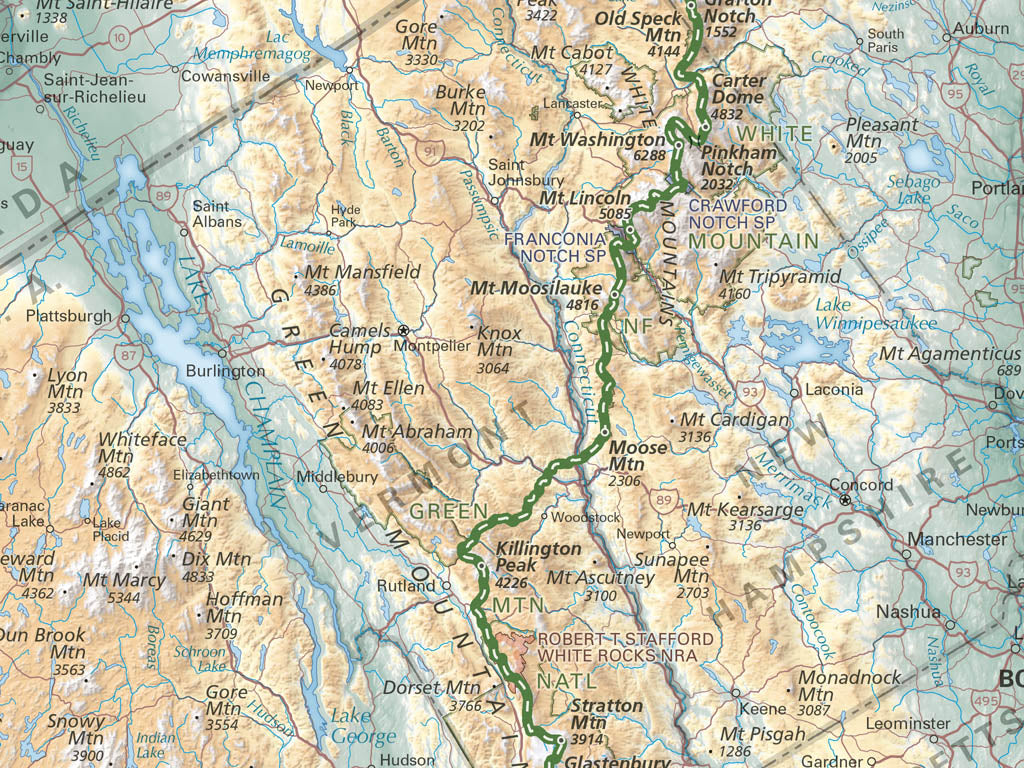
Appalachian Trail Fine Art Print Map
Couldn't load pickup availability
- SKU: PODRP_APP_TRAIL_ELEV_16X42_WA
Explore the full length of this legendary long-distance hiking route with our fine art print map of the Appalachian Trail. From Springer Mountain in Georgia to Mount Katahdin in Maine, our classic hypsometric tints combine with shaded relief to illustrate the ranges, ridges, and summits that define the AT's roughly 2,200-mile-long route. Over 1,500 hand-placed labels mark key features along the way, from summits and gaps to public lands and major road crossings. Labels for states, cities, and other features provide geographic context for the trail as it follows the spine of this ancient and rugged mountain range.
Whether you're reminiscing about your own thru-hike or dreaming of future day trips in the mountains, this stunning map serves as both a reference and an inspiration for adventure along the Appalachian Trail.
- Type: Flat Map
- Subtype: Wall Art
- Publication Date: 2026-04-01
- Regions Covered: Mid-Atlantic/Northeastern U.S., North America, Southern U.S.
- Countries Covered: United States
- Folded Size: N/A
- Unfolded Size: 42" (W) x 15.75" (H)
- Finish: Regular Paper