Fishing Hot Spots
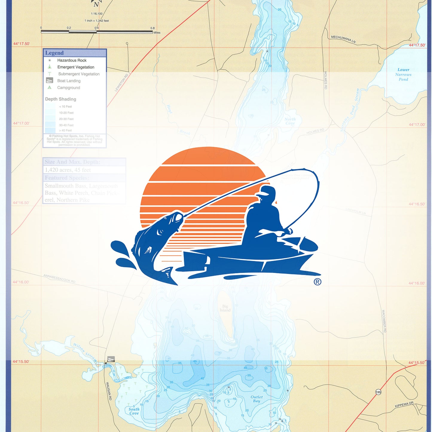
Annabessacook Lake Fishing Map
Annabessacook Lake Fishing Map
Regular price
$13.95 USD
Regular price
Sale price
$13.95 USD
Unit price
per
Shipping calculated at checkout.
Couldn't load pickup availability
- SKU: FHS_ANNABESS_
- Access to Lake Annabessacook is limited to a steep launch located at the bridge over Wilson Stream on Waugan Road. This site has very limited parking and traffic congestion can create a hazard here. Launching is also available for patrons of the Augusta West Lakeside Kampground, located off the Holmes Road along the east shore. Featured Species: Brown Trout, Smallmouth Bass, Largemouth Bass, White Perch, Yellow Perch, Chain Pickerel. Map Features: Waterway Profile, Accesses, Fishery Information, Contour Lines.
- Type: Folded Map
- Subtype: Fishing
- Language: English
- Scale: 1:16100
- Regions Covered: Mid-Atlantic/Northeastern U.S., North America
- Countries Covered: United States
- States Covered: Maine
- UPC: 071365904029
- MPN: G402
- Folded Size: 6" (W) x 9" (H)
- Unfolded Size: 12" (W) x 18" (H)
- Weight: 2 oz