Raven Maps
Alaska Elevation Tints Fine Art Print Map
Alaska Elevation Tints Fine Art Print Map
Couldn't load pickup availability
- SKU: PODRP_AK_ELEV_80X44_WA
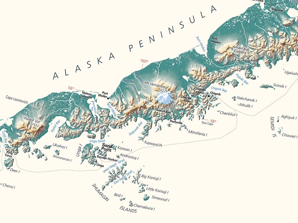
Our map of Alaska uses elevation tints in subtle hues of green, tan, and brown to show the differences in elevation throughout Alaska, from sea level at the Gulf of Alaska, the Bering Sea, and the Arctic Ocean to Denali (20,310').
We have three new versions of this fine art map of Alaska: Giant (44" X 81"), Large (original size 35" X 64"), and Small (24" X 44"), which has the same physical detail but with the smallest class of names removed for legibility.
This Alaska topographic map displays an incredible amount of detail, from cities, highways, and mountain ranges, to valleys, rivers, and small towns. The elevations of Alaska are represented by color, and this, in combination with their special relief shading technique, gives the map a lush, 3-dimensional look.
Dimensions: All map dimensions are approximate.
- Type: Flat Map
- Subtype: Wall Art
- Language: English
- Regions Covered: North America, Northwestern U.S.
- Countries Covered: United States
- States Covered: Alaska
- UPC: 767020010555
- MPN: alaska-elevation-tints-map
- Folded Size: N/A
- Unfolded Size: 80" (W) x 44" (H)
- Finish: Regular Paper