USSR Ministry of Defense
Akron, OH 1 (USA) - Soviet Military City Plans
Akron, OH 1 (USA) - Soviet Military City Plans
Regular price
$49.95 USD
Regular price
Sale price
$49.95 USD
Unit price
per
Shipping calculated at checkout.
Couldn't load pickup availability
- SKU: SUAA-AKRON1-P
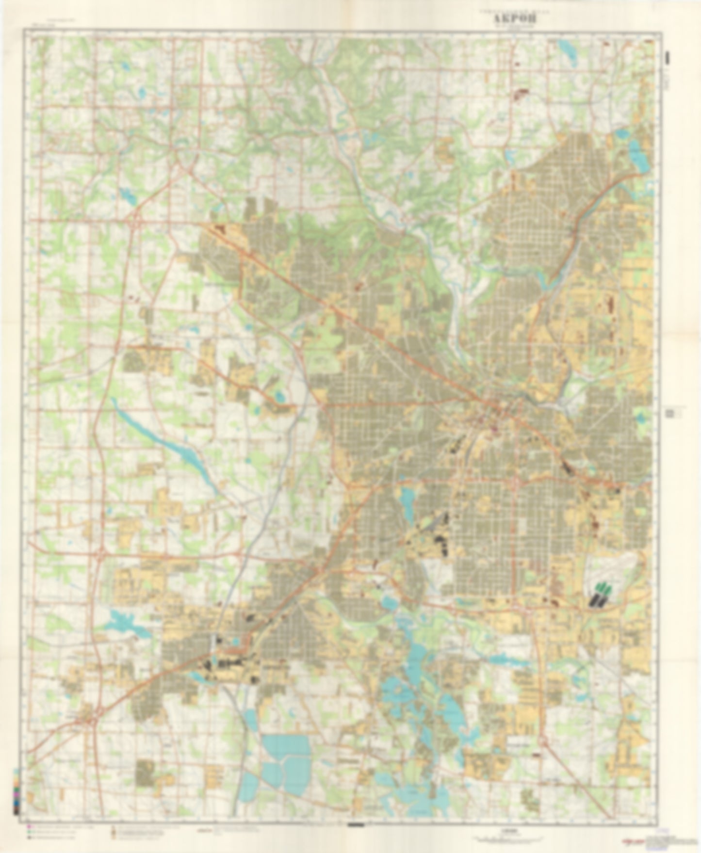
- During the Cold War and before easy access to high-resolution satellite imagery, The Soviet Military was secretly mapping the entire world. These aesthetically striking maps are beautiful down to the last detail and fantastic wall art and until now, have rarely been viewed or available to outsiders. This series has been covered by Wired Magazine and Greg Miller in his book, "All Over the Map: A Cartographic Odyssey". This map is part of the Soviet City Plans Series presented by East View, which has the largest collection of Soviet Military City Plans in the world. The Soviet Military City Plan(s) of Akron, OH 1 (USA) is one in a series of highly detailed topographic city maps developed by the USSR Ministry of Defense during the Cold War era. These collectable, high resolution print-on-demand editions are delivered on premium, acid-free, matte paper. This item is sheet number 1 in a set of 2 sheet(s) for Akron, OH Populated Places: City of Akron, City of Barberton, City of Cuyahoga Falls, City of Fairlawn, City of Norton, Summit County, Township of Bath, Township of Copley, Township of Coventry, Township of Northampton (historical) Landmarks and Natural Features: Coal Hill, Myers Island, Sherbondy Hill, Turkeyfoot Beach, Turkeyfoot Island Water Bodies: Barberton Reservoir, Columbia Lake, Cottage Grove Lake, Crystal Lake, Crystal Lake, Cuyahoga Falls Low Head Reservoir, Cuyahoga River Reservoir, Dollar Lake, East Reservoir, Firestone Reservoir, Grape Lake, Hower Lake, Kool Lake, Lake Anna, Lake Dorothy, Lake Nesmith, Latham Bay, Lily Hill Lake, Long Lake, Long Lake Channel, Loyal Oak Lake, Miller Lake, Mud Lake, North Reservoir, Portage Lakes, Portage Lakes, Rex Lake, Schocalog Lake, Silver Lake, Summit Lake, Turkeyfoot Lake, Vesper Lake, West Reservoir, Wonder Lake, Wyoga Lake
- Type: Map
- Subtype: City Plan
- Language: Russian
- Publication Date: 1978-06-01
- Scale: 1:25,000
- Regions Covered: Midwest, North America
- Countries Covered: United States
- States Covered: Ohio
- MPN: AKRON 1
- Folded Size: N/A
- Unfolded Size: 35.6" (W) x 43.3" (H)
- Weight: 4.8 oz