Map Adventures
Acadia National Park Waterproof Trail Map
Acadia National Park Waterproof Trail Map
Regular price
$11.95 USD
Regular price
Sale price
$11.95 USD
Unit price
per
Shipping calculated at checkout.
Couldn't load pickup availability
- SKU: MADV_ACADIA_WP_25
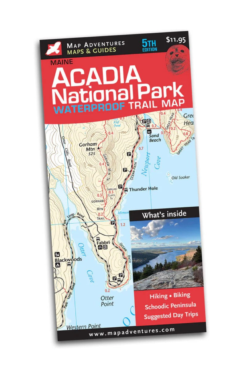
5th Edition The beauty of this spectacular area makes for the best hiking and biking that Maine has to offer. Acadia National Park is an area you will want to come back to visit - over and over. This rugged, waterproof map will last for trip after trip. Now with Schoodic Penisnsula and the new Visitor Center.
Map Features:
- 21 suggested hikes
- 6 suggested biking routes
- a whole island map of Mount Desert Island
- mileage between points on trails and Carriage Roads
- Carriage Road intersection signpost numbers—useful info for bikers & hikers
- Island Explorer bus stops
- latitude/longitude grid for GPS users
- campgrounds
- points of interest
- detail map of Bar Harbor
- index of trails, with difficulty ratings
Areas Covered
National Park land in the East and West Sides, including:- Bar Harbor
- Somes Sound
- Jordan Pond
- Eagle Lake
- Long Pond
- Echo Lake
- Bass Harbor
- Seal Cove Pond
- Southwest Harbor
- Northeast Harbor
- Norumbega Mountain
- Bernard Mountain
- Cadillac Mountain
- Type: Folded Map
- Subtype: Hiking
- Language: English
- Publication Date: 2025-05-01
- Scale: 1:20,500
- Regions Covered: Mid-Atlantic/Northeastern U.S., North America
- Countries Covered: United States
- States Covered: Maine
- ISBN: 9788900605891
- Folded Size: 4" (W) x 9" (H)
- Unfolded Size: 36" (W) x 24" (H)
- Weight: 1.7 oz