National Geographic Maps
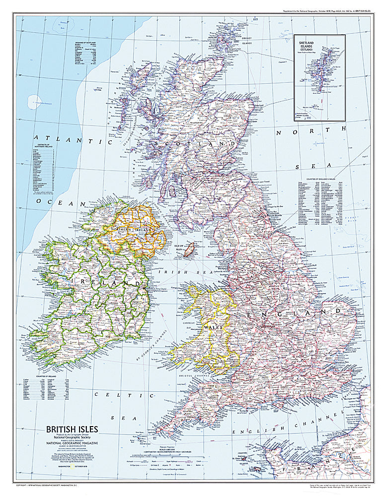
1979 British Isles Map
1979 British Isles Map
Regular price
$29.95 USD
Regular price
Sale price
$29.95 USD
Unit price
per
Shipping calculated at checkout.
Couldn't load pickup availability
- SKU: PODHNG_UK_79
- This attractive modern map of the British Isles includes ferry routes along with places of interest such as ruins and battle sites. Published in October 1979 as a companion to the historical map "Medieval England".
- Subtype: Political
- Language: English
- Publication Date: 1979-06-01
- Countries Covered: United Kingdom
- MPN: HM19791001
- Folded Size: N/A
- Unfolded Size: 22.75" (W) x 29.25" (H)
- Weight: 16 oz