National Geographic Maps
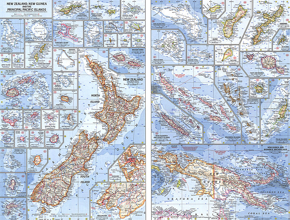
1962 New Zealand, New Guinea and the Principal Pacific Islands Map
1962 New Zealand, New Guinea and the Principal Pacific Islands Map
Regular price
$24.95 USD
Regular price
Sale price
$24.95 USD
Unit price
per
Shipping calculated at checkout.
Couldn't load pickup availability
- SKU: PODHNG_NZ_PNG_62
- This map of the Pacific Ocean includes Australia, the Pacific Islands, and the continental coastlines that border the ocean. Inset maps provide detail of some of the larger islands groups. Published in April 1962, this map accompanied an article on New Zealand and the map of New Zealand, New Guinea and the Principal Pacific Islands.
- Subtype: Political
- Language: English
- Publication Date: 1962-06-01
- Regions Covered: Pacific Ocean
- MPN: HM19620402
- Folded Size: N/A
- Unfolded Size: 25" (W) x 19" (H)
- Weight: 16 oz