National Geographic Maps
1958 Poland and Czechoslovakia Map
1958 Poland and Czechoslovakia Map
Regular price
$24.95 USD
Regular price
Sale price
$24.95 USD
Unit price
per
Shipping calculated at checkout.
Couldn't load pickup availability
- SKU: PODHNG_POL_CZ_SK_58
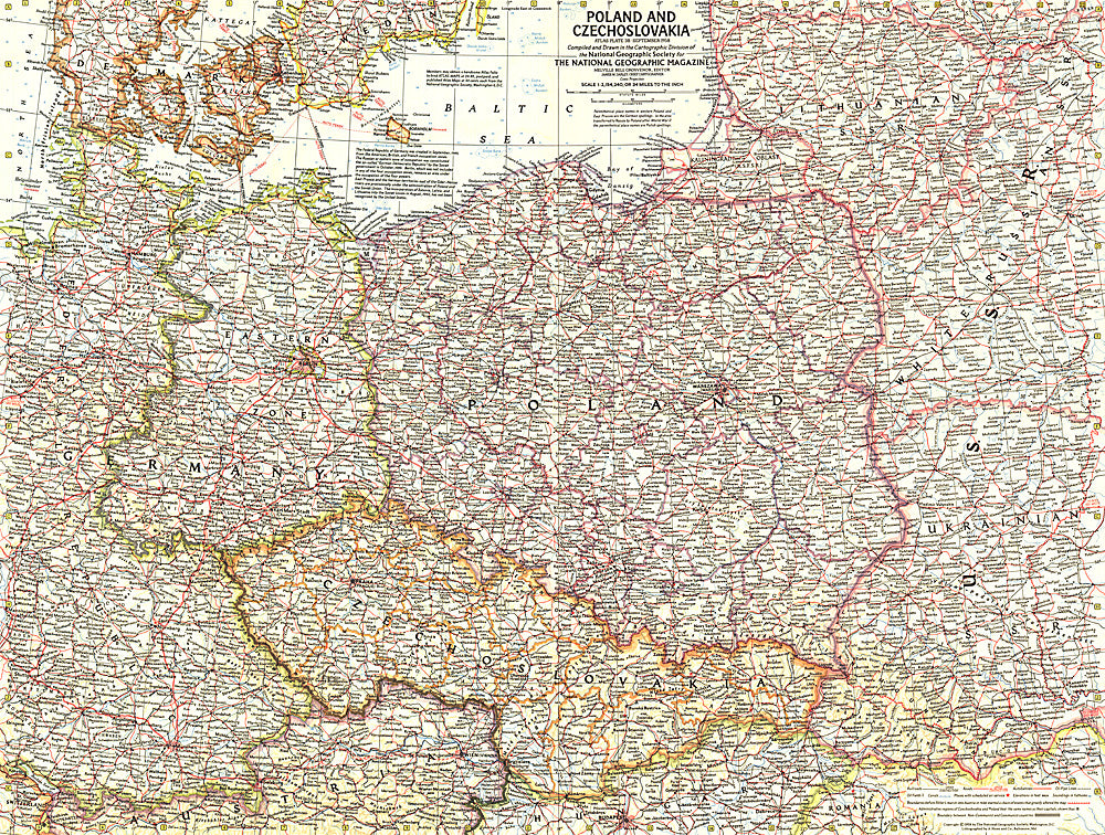
- This detailed map of Poland and Czechoslovakia contains notes about territories and administration during the Cold War era. Several boundaries are shown including those before Germany's invasion of Austria and those between communist and non-communist countries. Published in September 1958.
- Subtype: Political
- Language: English
- Publication Date: 1958-06-01
- Countries Covered: Czechia, Poland, Slovakia
- MPN: HM19580900
- Folded Size: N/A
- Unfolded Size: 25" (W) x 18.75" (H)
- Weight: 16 oz