Latitude 40° Maps
Vail and Eagle Trails Hiking Map
Vail and Eagle Trails Hiking Map
Regular price
$14.95 USD
Regular price
Sale price
$14.95 USD
Unit price
per
Shipping calculated at checkout.
Low stock
Couldn't load pickup availability
- SKU: LAT40_VAIL_23
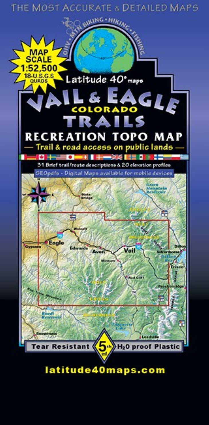
- Vail and Eagle Trails features the Vail and the Eagle Valleys with the stunning, jagged peaks of the Gore Range backdrop to the east and Mount of the Holy Cross in the northern Sawatch Range to the south. Serene Gold Medal fishing in Gore Creek and the free flowing Eagle River. Vast forests of Aspens and Lodgepole pine give way to higher elevation Subalpine fir and Engleman spruce with great trails and roads to explore in this beautiful area. Latitude 40° published the first generation (a very different version) of this map for the 1994 UCI Mountain Biking World Championships. Two-sided map covers 26 miles north to south from 1 mile north of Piney Lake, south to Crooked Creek Pass. East to west for 42 miles from Copper Mtn. Village on I-70, west to Eagle County Regional Airport- west of the town of Eagle. Includes large portions Eagles Nest and Holy Cross Wilderness. Sylvan Lake State Park, State Wildlife areas and State Trust Land. All hiking and mtn. biking trails on Vail Ski Resort, Beaver Creek Ski Resort and Arrowhead Ski Area. Hiking trails and singletrack on the north side of I-70 in Vail and Avon (Singletree and Avon Preserve). Over 100+ miles of singletrack in Hardscrabble Mountain Special Recreation Management Area (SRMA) surrounding the town of Eagle. Motorized singletrack in Bocco Mountain Extensive RMA north of Wolcott. Explore the Top of the Rockies Scenic Byway/10th Mountain Division Memorial Highway from the town of Minturn following the Eagle River up to Camp Hale National Historic Site. Highlighted public access for hiking, equestrian, mtn. biking and OHV use. Fly fish the Gold medal waters of Gore Creek and the Eagle River with numerous public access and private fishing areas. Trailheads, campgrounds, dispersed camping, picnic areas, day use areas and parking/pullouts. 10th Mountain Division mountain huts, cabins, inns, mines, adits, caves, remnants of old mills and mining camps, ghost towns, historical townsites and points of interest, interpretive sites, special geologic areas and scenic viewpoints/overlooks. Includes trail/route mileage and difficulty ratings. 20 detailed trail/route descriptions and elevation/distance profiles plus 31 additional brief trail/route suggestions. Paved recreation pathways connect Copper Mountain Village west to Vail Pass, Vail, Eagle and continue (off of this map) to Dotsero and the beginning of the Glenwood Canyon bike path. Reference our regional map, Crested Butte-AspenGunnison Trails to connect and follow routes that go beyond this maps southern boundary. The Summit County Trails Map overlaps this map to the east.
- Type: Folded Map
- Subtype: Hiking
- Language: English
- Publication Date: 2023-06-01
- Scale: 1:50,000
- Regions Covered: Central U.S., North America
- Countries Covered: United States
- States Covered: Colorado
- ISBN: 9781879866515
- Folded Size: 4" (W) x 8" (H)
- Unfolded Size: 25" (W) x 39" (H)
- Weight: 3 oz