USSR Ministry of Defense
Saint Petersburg, FL (USA) - Soviet Military City Plans
Saint Petersburg, FL (USA) - Soviet Military City Plans
Regular price
$49.95 USD
Regular price
Sale price
$49.95 USD
Unit price
per
Shipping calculated at checkout.
Couldn't load pickup availability
- SKU: SUAA-SAINTPETERSBURG-FL-P
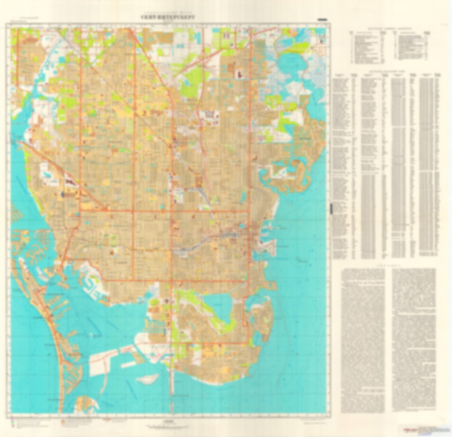
- During the Cold War and before easy access to high-resolution satellite imagery, The Soviet Military was secretly mapping the entire world. These aesthetically striking maps are beautiful down to the last detail and fantastic wall art and until now, have rarely been viewed or available to outsiders. This series has been covered by Wired Magazine and Greg Miller in his book, "All Over the Map: A Cartographic Odyssey". This map is part of the Soviet City Plans Series presented by East View, which has the largest collection of Soviet Military City Plans in the world. The Soviet Military City Plan(s) of Saint Petersburg, FL (USA) is one in a series of highly detailed topographic city maps developed by the USSR Ministry of Defense during the Cold War era. These collectable, high resolution print-on-demand editions are delivered on premium, acid-free, matte paper. This item is sheet number 1 in a set of 1 sheet(s) for Saint Petersburg, FL Populated Places: City of Gulfport, City of Pinellas Park, City of Saint Pete Beach, City of Saint Petersburg, City of South Pasadena, Saint Petersburg Division, Town of Kenneth City Military and Defense: Coast Guard Air Station Clearwater Landmarks and Natural Features: Bahama Beach, Bay Point, Bird Key, Boca Ciega Isle, Cats Point, Coquina Key, Deadman Key, Dog Leg Key, Eden island, Gulfport Middle Ground, Indian Key, Isla del Sol, Lido Beach, Long Key, Maximo Point, Mud Key, Paradise Island, Pass-a-Grille Beach, Pine Key, Pinellas Peninsula, Point Pinellas, Snell Isle, South Causeway Isles, Weedon Hammock, Weedon Island Water Bodies: Bayou Grande, Big Bayou, Blind Pass, Boca Ciega Bay, Butterfly Lake, Clam Bayou, Coffeepot Bayou, Crescent Lake, Cross Bayou, Devils Elbow, Eagle Lake, Lake Disston, Lake Maggiore, Lake Sheffield, Leslee Lake, Little Bayou, Little McPherson Bayou, Long Bayou, Main Channel, Masters Bayou, Maximo Channel, McKee Lake, McPherson Bayou, Mirror Lake, Mud Key Cutoff, Pasadena Lake, Pass-a-Grille Channel, Placido Bayou, Riviera Bay, Round Lake, Sawgrass Lake, Smacks Bayou, Snell Island Harbor, Sunshine Skyway Channel
- Type: Map
- Subtype: City Plan
- Language: Russian
- Publication Date: 1977-06-01
- Scale: 1:25,000
- Regions Covered: North America, Southern U.S.
- Countries Covered: United States
- States Covered: Florida
- MPN: SAINT PETERSBURG, FL
- Folded Size: N/A
- Unfolded Size: 37.3" (W) x 36.1" (H)
- Weight: 4.8 oz