USSR Ministry of Defense
Albany, Schenectady, Troy, NY 2 (USA) - Soviet Military City Plans
Albany, Schenectady, Troy, NY 2 (USA) - Soviet Military City Plans
Regular price
$49.95 USD
Regular price
Sale price
$49.95 USD
Unit price
per
Shipping calculated at checkout.
Couldn't load pickup availability
- SKU: SUAA-ALBANY2-P
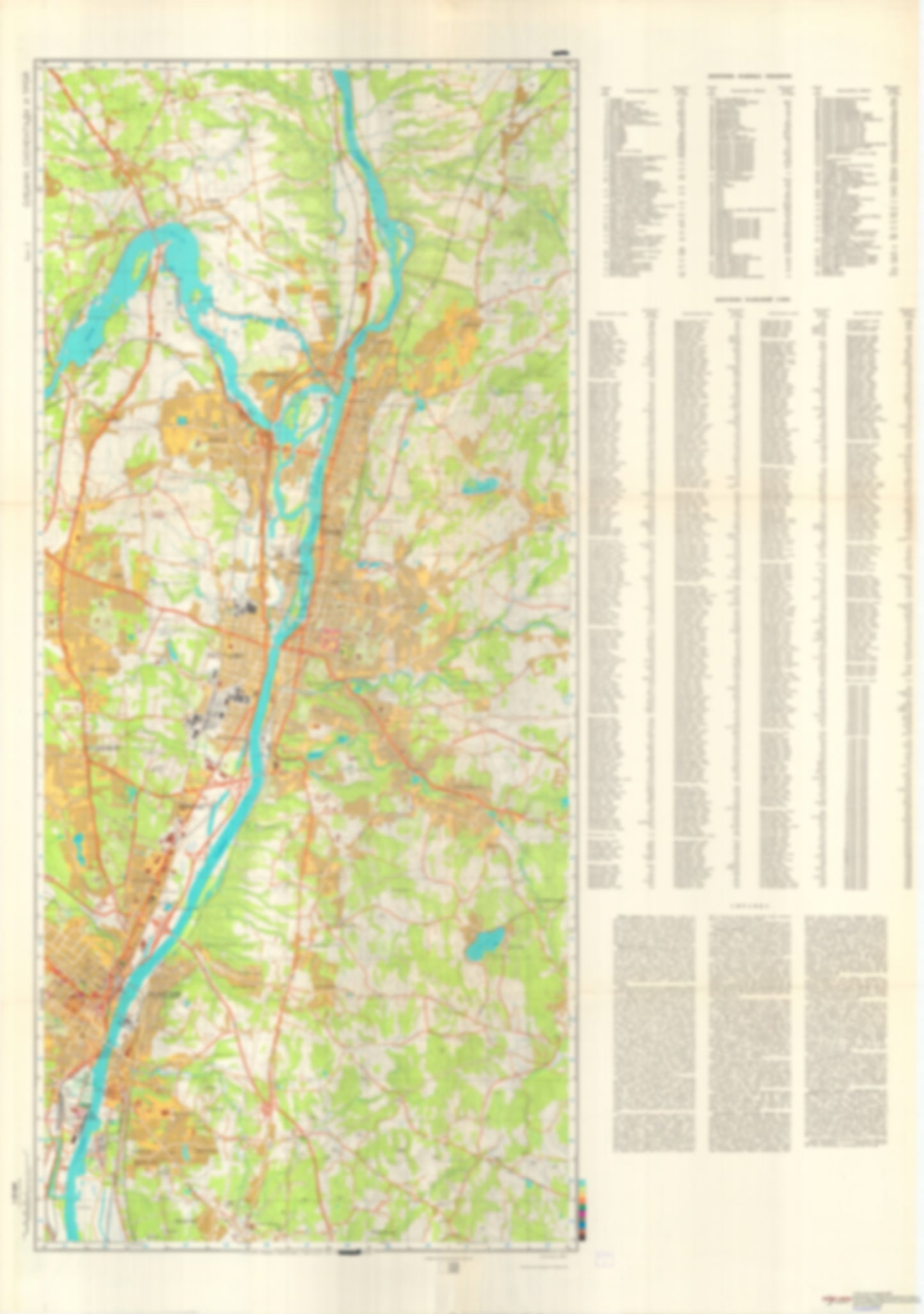
- During the Cold War and before easy access to high-resolution satellite imagery, The Soviet Military was secretly mapping the entire world. These aesthetically striking maps are beautiful down to the last detail and fantastic wall art and until now, have rarely been viewed or available to outsiders. This series has been covered by Wired Magazine and Greg Miller in his book, "All Over the Map: A Cartographic Odyssey". This map is part of the Soviet City Plans Series presented by East View, which has the largest collection of Soviet Military City Plans in the world. The Soviet Military City Plan(s) of Albany, Schenectady, Troy, NY 2 (USA) is one in a series of highly detailed topographic city maps developed by the USSR Ministry of Defense during the Cold War era. These collectable, high resolution print-on-demand editions are delivered on premium, acid-free, matte paper. This item is sheet number 2 in a set of 2 sheet(s) for Albany, Schenectady, Troy, NY Populated Places: City of Cohoes, City of Rensselaer, City of Troy, City of Watervliet, Town of East Greenbush, Town of Green Island, Town of North Greenbush, Town of Waterford Military and Defense: Troy - Glenmore Road Armory, Troy - South Lake Armory, Watervliet Arsenal Parks and Reservations: Westerlo Island Landmarks and Natural Features: Adams Island, Beacon Island, Bock Island, Breaker Island, Cabbage Island, Campbell Island, Collins Island, Fiona Island, Goat Island, Grandview Hill, Hallenbeck Hill, Jan Gowson Island, Lower Patroon Island, Mount Olympus, Mount Rafinesque, Olcott Hill, Patroon Island, Peebles Island, Prospect Hill, Rice Mountain, Rysedorph Hill, Second Island, Simmons Island, Starbuck Island, Stomy Island, Teller Hill, Van Schaick Island Water Bodies: Bradley Lake, Ida Lake, Lansingburgh Reservoir, Little River, Littles Lake, Menands Reservoir, Snyders Lake, Tivoli Lake, Troy Reservoir, Wright Lake
- Type: Map
- Subtype: City Plan
- Language: Russian
- Publication Date: 1978-06-01
- Scale: 1:25,000
- Regions Covered: Mid-Atlantic/Northeastern U.S., North America
- Countries Covered: United States
- States Covered: New York
- MPN: ALBANY, SCHENECTADY, TROY 2
- Folded Size: N/A
- Unfolded Size: 36.3" (W) x 51.5" (H)
- Weight: 4.8 oz